Edited by Michael Lewyn (mlewyn@hotmail.com)
With assistance from Doug Stewart, Larry Johnson, Sally Flocks, Michael Hintze, Alan Steinbeck, Brian Karpinski, Diane
Murley and numerous others.
(Special thanks to the following for allowing us to use pictures off the Web: Larry Johnson, Kevin Hutchby.)
TABLE OF CONTENTS
INTRODUCTION
CH. 1: Walking in Atlanta
CH. 2: Public transit
A. MARTA
B. CCT
C. C-TRAN
D. GCT
E. OTHER
CH. 3: Taxis and shuttles
CH. 4: Bicycling
CH. 5: Getting to major amenities via transit
CH. 6: Atlanta-area neighborhoods
A. Downtown
B. Northeast
C. Northwest
D. Southeast
E. Southwest
F. Other
CH. 7: Getting out of town
(followed by links)
For a (somewhat messier) version of this page with a bookmarked table of contents go https://lewyn.tripod.com/carfree4.htm
INTRODUCTION
Tell native Atlantans that you found a website about getting around Atlanta without a car and you might hear a surprised,
"That’s ridiculous—you can’t get around Atlanta without a car!" To be sure, few Atlantans would describe
Atlanta as a paradise for transit riders, cyclists, and pedestrians. But even in Atlanta there are choices for those who don’t
or can’t drive.
This document is about those choices–the alternative ways you have to get around metro Atlanta without a car. Our
purpose is to expand your transportation horizons by helping you learn about new ways to get around. You have many great ways
to get where you’re going without having to drive yourself, especially in the city of Atlanta and its inner suburbs.
You can move to Point A to Point B inexpensively and (sometimes) conveniently by bus, train, taxi, bicycle and your own feet.
23.5% of intown Atlanta households (and even a few suburbanites here and there) already live a totally car-free lifestyle–either
by choice or by circumstance. More would love to be car-free more of the time; some wish they could avoid automobiles entirely,
while others merely wish they could do so during their rush-hour commute to work.
Whatever your situation, this website gives you all the information you’ll need to get around without driving. A
less vehicle-dependent lifestyle can be a better lifestyle – not just for those who live it, but for everybody in Greater
Atlanta. How we choose to move influences the shape of our own lives, as well as the quality of our neighborhoods or region.
For example, walking and cycling combine transportation with exercise, while helping to create a cleaner, quieter city environment.
Besides, worrying about breakdowns, car break-ins, traffic jams, parking problems, potholes, expensive repairs and road rage
doesn’t have to be an unavoidable evil of living in cities the size of Atlanta. Why not consider a few ways to simplify
your life, demonstrate care for your community, benefit from a lower-stress lifestyle, and save some money in the process?
The car-dependent lifestyle isn’t cheap, if you think about how much owning and operating a car costs. The American
Automobile Association estimates that the average cost for owning and operating a new car is $6,400 per year. And don’t
forget the billions of dollars we pay in taxes every year to subsidize the infrastructure of the car culture– roads,
traffic cops, military spending to protect Arab oil. What would you do with an extra few thousand dollars a year?
There’s no question that trying new things can be challenging. Many of us aren’t really sure what transportation
options are available out there. But, whether you wish to travel car free for an everyday commute, an evening out with friends,
or a spontaneous weekend getaway, this book does much of the legwork for you. Phone numbers, transit information and neighborhood
profiles are here to help you plan your travels. Public transit is an obvious car-free alternative, and we outline metro Atlanta’s
transit systems. Beyond the bus and rail systems, we profile bicycling, walking and taxicabs as possible local options. Just
think–if you choose a car-free lifestyle, you’ll enjoy the freedom of not looking for a parking space, not having
to pump gas in bad weather, and not fighting traffic and road-rage craziness. Now read on and see how it can happen!
CHAPTER ONE: WALKING IN ATLANTA
For the past fifty years, roads and buildings in metro Atlanta have been planned, designed and built to serve the automobile.
Streets have gotten wider, blocks longer, and roadway design speeds higher. Because most of metro Atlanta has been built in
the last fifty years during this automobile-oriented age, pedestrian access to the city has definitely suffered.
However, attitudes about the need for transportation alternatives have changed significantly in Atlanta over the past decade.
The issue of non-motorized transportation safety and access now enters the discussion of all new roadway projects. In addition,
many governments around the region are now undertaking the task of retrofitting existing downtown areas and commercial centers
to accommodate various types of transportation choices. These efforts are being matched by a renewed interest among developers
in bringing buildings to market that have the function and appearance of a pedestrian-friendly area. Although the going is
slow, there have been significant advances in improving pedestrian infrastructure and there are surely more to come.
Despite the positive trends in thinking about urban transportation choices, Atlanta pedestrians must come to terms with
two difficult realities: the physical difficulties of the walking landscape and the culture of driving that exists among most
region’s inhabitants.
There are physical barriers in Atlanta that make being on the street without a car a little difficult and a little more
dangerous than other places. But with some practice, caution and understanding the rules, navigating Atlanta on foot is fun
and rewarding.
The Pedestrian’s Bill of Rights
The Georgia Driver’s Code, like that in nearly every state, gives pedestrians the right of way in crosswalks. In
Georgia, drivers must stop and stay stopped for pedestrians if a pedestrian is:
C
in a marked crosswalk or in an unmarked intersection with no traffic control signals
C
at any intersection, when the driver is making a left or right turn , unless a green arrow
is lit.
C
at a stop sign;
C
on the sidewalk, when the driver is entering a street or highway from an alley, driveway,
or private road;
C
still in the crosswalk when the traffic signal is green;
C
a blind person who is crossing a street and is carrying a white cane or being guided by
a dog.
As a pedestrian, you must always assume that drivers, even if they know the rules, are not very good at practicing them.
Cautious confidence will win the day. At intersections, even when the "Walk" sign is flashing, motorists will make turns and
disregard pedestrians trying to cross. But the seasoned walker will give the message to the drivers around them that they
are going to take the right of way, usually by eye contact and especially to those who are turning, and proceed through the
intersection. It is amazing how restrained drivers can be when reminded of the presence of other people using the street and
the rules of engagement. The Atlanta driver knows very well that any hesitation or abnormal act can result in getting
honked at, getting cut off, or driven around. Why should the pedestrian expect anything different? You must use good judgment,
but always stake your claim.
CHAPTER TWO: GETTING AROUND ATLANTA ON PUBLIC TRANSIT
Four agencies currently provide public transit in the Atlanta Metropolitan Area. MARTA (Metropolitan Atlanta Rapid
Transit Authority) provides bus and rapid rail service in Fulton and DeKalb Counties. CCT (Cobb Community Transit)
provides bus service in Cobb County, with connecting service to MARTA. Clayton County has Clayton Transit (C-TRAN)
and Gwinnett County has Gwinnett County Transit (GCT). C-TRAN runs five buses to and from the Hartsfield-Jackson International
Airport MARTA rail stop, while GCT runs bus routes both to downtown Atlanta and through Gwinnett County.
A. MARTA
1. MARTA basics
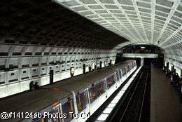
MARTA operates in Fulton County and DeKalb County with over 100 bus routes. MARTA’s rail cars serve riders at 38
stations and cover over 47 miles of double track. Although Gwinnett County, Cobb County and Clayton County all have their
own bus systems, MARTA remains the largest of all providers and has the lion’s share of transit users in the region.
MARTA was designed to get people into the city from the suburbs, and the system does this very well. Getting to Downtown
and most parts of Midtown by train has many advantages over taking the very unpredictable interstate system. Downtown and
Midtown combined have by far the largest number of "day jobs" in the region and are followed by Perimeter, Buckhead and Cumberland.
If office work is not your thing, Perimeter and Buckhead offer the most variety of jobs in entertainment, restaurants, retail
and other services that are easily accessible by transit.
Despite the bias in the design of the MARTA system toward the suburb-to-city commute, many workers who are going from city
to suburb are increasingly relying on it, especially for getting to the northern part of the city. Do not expect excellent
walking conditions anywhere around stations that are north of Buckhead and Lenox, but do not rule out using the system to
get to these areas. Bus service in the suburbs is often fast and reliable. Try a few practice runs before you decide that
taking the car is a must. Some bus lines are more reliable than others because of traffic congestion problems. A good source
of information is the riders who are waiting for the bus at the train station in the morning. Most regular MARTA commuters,
especially bus riders, are happy to share their experience with you and often know almost as much about the routes as the
drivers.
MARTA’s rail system operates from approximately 5:00 a.m. until 1:00 a.m. seven
days a week. The system includes three main rail lines, two running north-south and one west-east. The North Line runs from
the Airport Station to North Springs Station and the Northeast Line runs from Airport Station to Doraville Station. The East-West
line runs from Hamilton E. Holmes Station to Indian Creek Station. There is also a spur on this line at Ashby Station that
connects to the Bankhead Station.
MARTA provides parking lots at many of its rail stations, especially those in suburban locations. Daily parking
is free of charge to MARTA customers, and long-term parking costs between $3 and $6 per day (depending on the station).
Many MARTA bus routes run from 5:00 a.m. to 1:00 a.m. Monday through Friday, and from 6:00 a.m. until 12:30 a.m. on weekends
and holidays. Some routes do not have evening or weekend service. Almost every bus route terminates at a rail station.
MARTA operates several convenient shuttle routes to popular destinations, including Turner Field, Lakewood Amphitheatre,
and the Six Flags Over Georgia amusement park. For more information, call (404) 848-4711.
2. Paratransit
MARTA provides lift vans for persons with disabilities who experience difficulty accessing fixed-route bus
or rail services. Vans operate on a curb-to-curb pick-up and drop-off basis for a one-way fare of $3.50. Service is available
in DeKalb and Fulton counties through advance registration.
3. Fare Structure
As of early 2005, a single $1.75 fare covers bus or train trips, including transfers. Fare media choices
and costs are:
One token: $1.75
Roll of 10 tokens: $17.50
20 one-way passes: $30 (at RideStores only)
Weekly TransCard: $13 (unlimited rides)
Monthly TransCard: $52.50 (unlimited rides)
Student Pass (elementary & high school): $10
Elderly/disabled half-fare (with card): $0.85
Out-of-district routes: $2.50 (6 Flags, Clayton)
A reciprocal fare agreement with CCT enables passengers to transfer from one system to the other at no additional charge.
Tokens and TransCards can be purchased at MARTA RideStores, located inside stations at Five Points, Lenox and the Airport,
or the Lindbergh Headquarters building. Tokens can also be purchased from token machines, located outside all rail station
entrances.
Although MARTA generally tries to make transferring between buses and trains convenient, living and/or working within walking
distance to a rail station makes life without a car much easier. Please see the neighborhoods chapter to determine the best
places to live as far as accessibility to MARTA Rail stations is concerned.
For additional route and schedule information call MARTA at (404) 848-4711. A complete list of routes along with maps and
timetables for all rail and bus routes is available on MARTA's web site at: http://www.itsmarta.com/getthere/schedules/index.htm
4. Practical Tips - bus
Use the bus driver and other passengers as a resource
If you aren't positive where a bus is going to take you, where you need to get off, where you can transfer or have some
other question about the bus route, talk to the driver. Most MARTA drivers know their routes and the MARTA system quite well
and can help you out. If you can't get the information you need from a bus driver, ask the passengers. Don't be shy!
Stopping the Bus
As you approach your stop, pull the overhead cord, or push the strip along the windows to let the driver know you want
to get off. Don’t signal for your stop too far ahead of time, most likely there will be another stop before yours and
you’ll either force the driver to make an unnecessary stop or you will be walking to where you wanted to get off.
Have bus schedules for the buses you use
You can pick up schedules for all bus routes at Five Points station downtown or at MARTA’s Lindbergh Headquarters
(near the Lindbergh stop on the North line). If you can't find a particular schedule there, just go to MARTA’s website
(http://www.itsmarta.com/getthere/schedules/index.htm) or call MARTA (404-848-4711) and ask them to send the schedule to you. MARTA rail stations also post
schedules for all the buses that stop there.
Be aware that many routes suffer delays from rush hour car traffic. Most drivers are very conscientious about staying on
schedule, but because there are no dedicated bus lanes they are as vulnerable to traffic problems as other motorists. If a
bus line is persistently off-schedule during peak hours, consider trying another bus line that may run through less busy streets
and run more reliably. While it may drop you off slightly farther away from where you live, it may end up saving you more
time.
Before you venture out on a bus route, check the schedule to make sure you can get back. Some buses stop running as early
as 7:00pm.
Have exact change
If paying bus fare with cash, always have the exact change (dollar bills, quarters, dimes and nickels are accepted); change
is not given on the bus. Be smart and make sure you have additional cash on hand so if you have to buy an additional token,
you won't be stranded. Tokens are accepted on both buses and trains.
Help make the system the best it can be.
In the (hopefully) rare instances when you do not find the help or level of service you expect, you should let MARTA know.
Here’s how: First, make sure you record all the necessary details (bus number, train line, name of driver, conductor,
or other MARTA official). Then, call MARTA customer service at (404) 848-4800 or send an email to customerserv@itsmarta.com
and report the incident.
Always sign your MARTA pass!
On the back of MARTA passes there's room for a signature. As soon as you get your card, be sure to sign it. If your card
is ever stuck in a turnstile and MARTA helps you get it out, they will look for the signature as proof that the card is yours.
5. Practical tips- trains
Stay Alert
Trains stop at every station. Usually (though not always), the station will be announced before every stop. There are also
signs at every station visible from the train window - stay alert so you know when to get off.
Exact Change
If you're using cash for the train, you need exact change to put in the turnstile or you'll need to buy tokens at nearby
token machines. If you are an occasional rider (i.e. once every couple weeks or so), it might make sense to buy tokens in
bulk to save time at the token machines. If you are a regular rider, a weekly or monthly transcard will save you time as well
as money.
6. How do transfers work?
It's pretty simple. In fact, if you have a pass, it's not even something you need to worry about because you don't need
a transfer at all. If you're paying in cash or by tokens and you need to catch a connecting bus, however, transfers are a
must. Here's an outline of how they work:
Train-to-bus: After you put your token or cash in the turnstile and walk through, push the transfer button to get your
transfer. Once you reach your station and want to get on the bus there, present your transfer to the driver. At certain stations
this will not be necessary as the buses come directly into the station and the bus driver knows you've just come off the train
and have already paid.
Bus-to-train: After feeding the bus with cash or tokens, ask the driver for a bus-to-rail transfer. You can only get this
if the bus is going to a rail station. Once you arrive at the station, stick the transfer card into the turnstile just as
you would a rail pass. The card is for one-time use and will not be returned.
Bus-to-bus: If for some reason you need to take one bus and transfer from it onto another one (the 48 to the 2, for example),
you need to ask the driver for a bus-to-bus transfer.
Note: Some bus depots are in the station (no transfer needed) and some require a transfer. Find out before you get there
or to be on the safe side, always get a transfer.
7. Bikes on MARTA
MARTA is one of the more bicycle-friendly transit agencies in the country. Bikes are allowed on trains and buses.
All rail stations have elevators and there's plenty of room on board for your bike. Once on the train, bikers should be
sure to minimize discomfort or obstructions to other passengers. Make sure your bike is not blocking an exit, an aisle or
several seats on a crowded train. Be alert for people trying to maneuver around your bike and move it out of the way as needed.
You should park your bike at the front or rear of the train car, where there is more space. Make a conscious effort to take
up as little room on the train as you need to.
MARTA has installed bike racks on their buses. For updates on this new service, you should check MARTA’s website,
www.itsmarta.com or call MARTA customer service at (404) 848-4800.
You may also wish to check with the Atlanta Bicycle Campaign at (404) 881-1112.
8. Shopping on MARTA
Some people use MARTA for recreational trips but shy away from using it to do things like grocery shopping because they
don't think it's possible. Don't be intimidated - it is possible, especially when you have the right tools and right attitude.
Even if you are buying a lot of things, you can bring them home without driving by:
a) using a two-wheeled, folding shopping cart. They cost about $20 at local grocery stores, hardware stores, and elsewhere.
Using one of these carts you can roll home an entire week's worth of groceries or load of books or even a computer system
without putting a strain on your back or arms. Using a cart avoids the problems of having to juggle dozens of bags or deciding
whether or not to buy heavy things - with a cart, unless it's really, really big, you can carry it yourself. The carts fold
up for easy carrying and easy storage or
b) Taking a taxicab home.
If you're not going to buy a lot but will be making a few stops, bring a backpack or shoulder bag. Buy some clothes, put
them in the backpack. Buy a book down the road, put that in as well. Take the train to get some supplies at the hardware store,
and put them in, too. When you get home you won't have all those plastic bags and you'll feel like you've really accomplished
something.
For buying furniture, remember that you can take MARTA to the store and nine times out of ten, they will deliver it to
your door, though usually at a charge. Home Depot will home-deliver certain items or you can rent a truck by the hour.
All of the hints above apply to the region's other transit services (discussed below) as well as to MARTA.
B. Cobb Community Transit Services (CCT)
CCT operates 15 bus routes. Most CCT routes run Monday through Saturday (but not on Sunday).
A few "express" routes, however, operate only during weekday rush hours. CCT primarily serves Cobb County’s three major
business activity centers: the "Platinum Triangle" located at the intersection of Interstates 285 and 75, the Town Center
area located in the north-central portion of the County near I-75, and the City of Marietta, centered around historic Marietta
Square.
All CCT vehicles are wheelchair lift-equipped, with interior and exterior equipment upgrades that comply
with the Americans with Disabilities Act (ADA). CCT has also equipped ts fleet with bicycle racks to accommodate bicycle/transit
trips.
Transfer Centers and Park/Ride Lots
Cobb County’s transit system includes two transfer centers, where a number of bus routes converge,
and four parking lots for which CCT has negotiated partial use as transit park/ride facilities. The transfer centers are located
at Cumberland Mall and near downtown Marietta (on S. Marietta Parkway at Aviation Drive). Neither of the transfer centers
provides any public parking spaces. Two of the park and ride lots are in Marietta (one at 800 S. Marietta Parkway, another
at the Johnson Ferry Baptist Church at 955 Johnson Ferry), a third is on Busbee Drive in Kennesaw, and a fourth is on Lake
Acworth Drive in Acworth.
CCT Paratransit Services
A fleet of lift-equipped vans provides paratransit service to people unable to access the fixed-route service
because of a disability. Qualified passengers can make reservations for curbside pick-up and be taken to their final destinations
or transferred to a fixed-route bus: Call (770) 427-2222. (For information about prices, see CCT Fare Structure.)
CCT Fare Structure
Local single rides are $1.25 for adults, and $0.80 for youth under age 18. Elderly passengers and passengers
with disabilities can pay half-fare ($0.60) to ride local routes during non-peak hours and all day Saturday. Children under
42" in height ride free.
Adult express fares are $3.00 one-way or $4.00 for a round-trip. Youth express fares are $1.80 one-way or
$2.55 for a round-trip. Paratransit single-ride fare for adults is $2.50; youth pay $1.60. Ten-ride tickets are available
for every fare category at a slightly discounted price. In addition, monthly passes are available as follows:
Adult-Local: $45.00
Adult-Express, one-way: $55.00
Adult-Express, round trip: $70.00
Adult-Paratransit: $90.00
Youth-Paratransit: $55.00
A negotiated arrangement between CCT and MARTA provides free transfer privileges for transit passengers.
Tickets and passes can be purchased online at the CCT web page, or by phone (770-428-1218).
C. CLAYTON TRANSIT (C-TRAN)
General System Description
As of January 2005, C-TRAN’s fixed route operations include five routes, all going from the airport
MARTA rail stop into Clayton County. Three of the five C-TRAN buses operate on Sunday.
All C-TRAN buses are wheelchair lift-equipped, and thus accessible for persons with disabilities. C-TRAN
buses are equipped with bicycle racks at the front of the bus to accommodate bicycle/transit trips.
C-TRAN’s fleet of lift-equipped vans provide paratransit service (for $3 each way) for persons unable
to access fixed-route service because of a disability. Qualified passengers may make reservations for paratransit vans: Call
(770) 848-5399.
Single rides are $1.50 per passenger, $0.75 for elderly and disabled passengers, and free for children under
5. Paratransit service is $3 each way. 20-ride passes are available for $26, and monthly passes are available for $52.50.
Tickets and passes can be purchased at Southlake Mall and at Kroger stores at the following locations: 8059 Tara Blvd. in
Jonesboro, and 7125 Highway 85 in Riverdale.
Transfers between C-TRAN and MARTA bus and train routes are free, as are transfers between C-TRAN buses.
D. GWINNETT COUNTY TRANSIT (GCT)
You may contact GCT by visiting its web page at
www.gctransit.com or by calling (770) 822-5010.
General System Description
As of March 2005, GCT’s operations include six express routes going from Gwinnett County to downtown
Atlanta, and five local routes.that serve destinations within Gwinnett County. One of the local buses (route 10) serves Doraville’s
MARTA rail station. Most of the local routes run Monday through Saturday, while the express routes are limited to weekday
rush hour service.
GCT buses have a rack on the front for two bicycles, and all Park & Ride lots have a place where riders
can lock their bikes.
GCT Fare Structure
Single rides on express buses are $3 one way. Ten-ride passes are available for $27, and monthly passes cost
$100.
Single rides on local buses are $1.75 per passenger. Ten-ride passes are available for $14. In addition,
monthly passes are available for $55. Seniors, youth and the disabled may purchase local bus trips for .85 apiece, or pay
$8.50 for a ten-ride pass. Paratransit rides cost $3.50 per ride or $35 for a ten-ride pass. Tickets and passes can be purchased
by contacting GCT at (770) 822-5010 or by mail. Pass-by-mail forms are available on GCT buses.
Transfers between GCT and MARTA bus and train routes are free, as is parking at GCT’s three Park &
Ride Lots (at I-85 and Indian Trail, Discover Mills Mall, and I-985 and SR 20). However, overnight parking is prohibited.
E. NEIGHBORHOOD-ONLY BUSES
The Buc (www.bucride.com) serves only Buckhead, and Royal Bus Lines runs buses up and down Buford Highway. For more details on these services
see neighborhood profiles of Buckhead and Chamblee/Doraville respectively.
CHAPTER THREE: TAXI AND SHUTTLE SERVICES
Not owning a car doesn’t preclude you from using one when you need to.
To get to your doctor’s office on a rainy day when you have the flu, a taxi may be well worth the cost.
Likewise, a taxi is a big help when you need to stock up on groceries for a week or pick up a 40-pound bag of dog food. Taxis
are also an efficient way to get between two meetings that are scheduled back-to-back when using MARTA would require too many
transfers to be feasible. Taxis also provide independence and convenience for traveling at night or on weekends, when bus
service is less frequent.
Taxis are less visible in Atlanta than in most major cities, so attempting to flag down a taxi is not your
best choice. Taxis tend to hang out near big hotels, particularly ones used for conventions, so if you’re located in
Downtown Atlanta, Buckhead, or Decatur, head to your nearest hotel. The concierge or other staff member will call the company,
and a taxi will show up quickly. If you want to be picked up at work or at home, call the taxi company. At Checker Cab and
some other taxi companies, the dispatcher will request your phone number. Checker’s Taxi drivers will call you when
they arrive, which means you don’t need to spend time waiting on the street. For other companies, ask the receptionist
whether the driver will call you. If you need to be picked up from a store, you can save time by calling when you get in the
checkout line.
Not all taxi drivers are completely familiar with the various parts of metro Atlanta, so don’t count
on them to know how to find your destination. If you don’t know the route, you can go to
www.mapquest.com and print out a map. Also, check to make sure the drivers turn on the meter. If they don’t, it is
a sure sign that they are going to charge you more than the normal rate.
Trouble with a Taxi?
If you have any trouble with or have left something in a taxi governed by the City of Atlanta (the taxi’s
number will start with 0001), call the Taxicab Bureau at (404) 658-7600. Provide the number of the cab, the name of the company,
the date and time, and the name of the driver (if you remember it).
Tips for better service when calling for a Taxi
C
Always be ready with your complete address and phone number.
C
Know where you are going and if you need to stop anywhere.
C
Tell them how many passengers if more than one or two.
C
If possible, know the closest cross-street.
C
Ask how long to expect the cab. Then ask, "Are you sure?"
C
Tell them if you are at a house, apartment or business.
C
If you have ridden before, request your favorite driver.
Some Atlanta Area Taxi Companies
Downtown/Virginia-Highlands/
Little 5 Points/Convention District/Georgia Dome
Bo's Taxi Service 404-577-2222 or 1-877-666-6668
Atlanta Lenox 404-872-2600
American Cab 404-873-1410
Ambassador Taxi 404-724-0220
Omega Taxi 404-249-9830
United Taxi 404-658-1638
American Cab 404-873-1410
National Cab 404-752-6834
Rapid Taxi 404-222-9888
Buckhead/Lenox/Lindbergh
Bo's Taxi Service 404-577-2222 or 1-877-666-6668
Atlanta Lenox 404-872-2600
Amigo Taxi 404-248-0106
Emory/Decatur/Avondale
Bo's Taxi Service 404-577-2222 or 1-877-666-6668
Atlanta Lenox 404-872-2600
Decatur's Best 404-289-6603
Decatur Jett Cab 404-289-3333
Dekalb County/Chamblee/
Doraville/Tucker/Northlake
69 Cab 770-986-0123
Quick Service 404-558-5940
Dunwoody Taxi 770-390-9997
Doraville Cab 770-451-2272
Dunwoody/Sandy Springs/N. Fulton
Su Taxi 404-255-6333
Alpha Cab 404-255-4955
Quick Service 404-558-5940
Dunwoody Taxi 770-390-9997
Norcross/Peachtree Corners/Gwinnett
Duluth/Lawrenceville
Gwinnett Taxi 770-963-0963
Doraville/Gwinnett Cab 770-968-6078
Metro Taxi 770-925-2277
Marietta/Kennesaw/E. Cobb/Smyrna/
Woodstock/Cherokee County
Action Cab 770-423-2222
Trip Taxi 770-924-1700
Cobb Taxi 770-956-7273
A-1 Taxi 770-434-8785
Cumberland Mall/Paces Ferry/Dobbins
Action Cab 770-423-2222
Cobb Taxi 770-956-7273
A-1 Taxi 770-434-8785
Stone Mountain/Lithonia/Conyers/
Snellville/Lilburn/Loganville
Stone Mtn. Taxi 770-469-9066
Decatur Yellow 404-377-3905
Decautur Best 404-289-6603
Checker Taxi Decatur 404-289-0333
Lithonia Best Cab 770-934-0354
South Atlanta/Riverdale/Clayton County/
College Park/Hapeville/Forest Park/Airport Area
Bo's Taxi Service 404-577-2222 or 1-877-666-6668
Payless Cab 770-909-9393
Dixie Cab 404-366-8101
E Z Taxi 404-766-5500
Harbor Light Cab 770-994-0730
Peachtree Dekalb Airport
Superior Airport Shuttle 770-457-4794
Mike Transportation Inc. 404-669-0900
Airport Transportation 404-299-3886
Star Coaches 404-364-0177
Gwinnett Field
Superior Airport Shuttle 770-457-4794
Mike Transportation Inc. 404-669-0900
Airport Transportation 404-299-3886
Star Coaches 404-364-0177
Charlie Brown Airport
Superior Airport Shuttle 770-457-4794
Mike Transportation Inc. 404-669-0900
Airport Transportation 404-299-3886
Star Coaches 404-364-0177
Hartsfield International/Atlanta Airport
Bo's Taxi Service 404-577-2222 or 1-877-666-6668
Superior Airport Shuttle 770-457-4794
Mike Transportation Inc. 404-669-0900
Airport Transportation 404-299-3886
Star Coaches 404-364-0177
Spanish-Speaking Taxi Services
La Familia Taxi 770-451-2272
Paisanos Taxi 770-220-0295
Los Primos Taxi 770-936-8400
Hispanos Taxi 770-458-6600
Guadalupana Taxi 770-455-0646
Amigo Taxi 404-248-0106
CHAPTER FOUR: BICYCLING IN ATLANTA
First, the bitter truth: Atlanta is one of the harder cities for bicycling in the U.S. Atlanta drivers tend
to be less tolerant of cyclists sharing the road than motorists in other cities, and bike lanes are few and far between. Effective
cycling here requires no small amount of poise and savvy.
However, if you pick your routes carefully, keep your bike in good working order, and—most importantly—respect
the rules of the road, bicycling in Atlanta can be a pleasure. Atlanta has a strong community of cyclists who regularly brave
its streets and share trade secrets. Some of Atlanta’s intown neighborhoods wind their way to commercial and office
districts, making cycling to work and to shop easier than one might think. And there is hope, though by no means certainty,
that the various city and state agencies responsible for Atlanta’s roads will make the safety and convenience of bicyclists
a higher priority in the coming years than they have in years past.
Many, though not all, parts of metro Atlanta are bikeable, and bicycling is safer than one might think: for
each hour spent on the road, bicyclists in Atlanta actually experienced fewer accidents than motorists. A half hour bike ride
is as good exercise as a half hour spent at the gym; you can run errands or ride to work and stay in shape at the same time.
Although Atlanta’s roads tend to favor the motorist and shortchange the cyclist, you can ride safely
and get where you need to go by following some basic rules:
1. Wear a helmet.
2. Make yourself highly visible—wear bright clothing in the daytime, use lights and reflective clothing at night.
3. Follow the same traffic laws as motorists—if you want motorists to treat you with respect, then you have to play
by the same rules that they do.
4. Be predictable—signal your intent well before turning or changing lanes, and don’t weave in and out between
parked cars.
5. Ride defensively—be ready for drivers to make mistakes or act rudely.
6. Scan behind you before making a lane change or moving out into a lane.
7. Ride in the proper lane for your intended direction—e.g. never ride in a "right turn lane" if you are only going
straight.
8. If you intend to carry items, plan ahead to use a backpack or baskets—never carry anything on your handlebars
or with one hand off the handlebars.
9. When riding in a group, never ride more than two abreast—ride single file if faster traffic cannot otherwise pass.
10. Keep your brakes and mechanical parts of the bike in good working order—you’ll be safer and enjoy the ride
more.
Although these sound simple enough, they are easier said than done: too few cyclists abide by all of these
rules. It requires a lot of patience and fortitude to be a law-abiding cyclist. Most of the roads in Atlanta are not built
to accommodate cyclists, and some motorists regard cyclists as a hindrance rather than as full and equal road-sharing partners.
Yet many Atlanta cyclists, of all ages and backgrounds—more of them in dresses and slacks than in spandex--find a way
to make the system work for them. The Atlanta Bicycle Campaign offers classes on effective cycling that will make you a better
city cyclist—you can sign up by calling (404) 881-1112.
There are some accessories that no rider should do without: a front and rear light; a water-bottle holder;
a Kryptonite lock. You should never go out riding at night without your lights. A reflector vest is also very helpful for
riding both night and day, especially if you ride on busier roads. Likewise, in spring and summer you will need to
bring a water bottle and drink out of it regularly. Don’t skimp on a lock. Kryptonite is nearly unbreakable and well
worth the investment. Also, it’s advisable to lock your front wheel along with your frame whenever you park your bike
-- and essential to do so if you have a quick-release wheel. Beyond this, your gear needs will depend on your circumstances.
Racks are useful, especially if you’re commuting to work. If you plan to shop, you will probably need panniers. A camelback
water container is extremely valuable for longer rides in the heat. If you find yourself riding on many busy arterial streets,
consider investing in a side mirror.
If you want to cycle regularly, you will probably find that the best opportunities to do so are in the eastern
half of the city of Atlanta and in nearby Decatur. Because the layout of these areas is generally older than in the rest of
the Atlanta area, they tend to be slightly more interconnected, smaller-scale, and more bicycle-friendly than the metro area.
Also, the city government is very pro-bicycle and many new bike lanes should come on line in the near future.
Most city streets, even the main arterial roads, are safe to ride on. There are some streets you should avoid,
like most of Ponce De Leon Avenue and North Avenue, and Peachtree Street anywhere north of Midtown. However, if you claim
your part of the lane and remain in the path of the cars--rather than retreating toward the curb where you will get squeezed
out by passing traffic—you will have little trouble with cars on most streets during most hours of the day.
If you would still prefer to stay off the busier roads, you can often find an alternative route. For example,
the Freedom Parkway bike trail will take you from the Midtown area to the Martin Luther King historic district just east of
downtown; it is a very pleasant morning commute if you work downtown. There are many other neighborhoods with easy access
to central commercial nodes of the city, such as Ansley Park (leading to the Midtown business district) and the Midtown residential
district between Tenth Street and Ponce De Leon Avenue. Shopping centers, such as Sage Hill in North Druid Hills, can be reached
from the downtown/midtown area by taking a mix of unthreatening commercial streets and quiet residential streets. It may take
a while to discover these routes, and they may be rather labyrinthine; but they usually exist in the intown area. The Atlanta
Bicycle Campaign also has bicycle maps for some parts of the metro area, which can help you figure out the most bike-friendly
routes for any given trip – if you’re interested, call them at (404) 881-1112.
Atlanta has recently developed a number of short bike paths throughout Midtown and DeKalb County. These paths
join with city streets to form something resembling a single bike route stretching from Freedom Parkway near downtown all
the way to Stone Mountain. Planning and financial support from the PATH Foundation has been largely responsible for these
great recreational cycling opportunities. The paths are particularly convenient for residents of Virginia-Highland, Inman
Park, and Candler Park. If you want to ride all the way to Stone Mountain, be prepared for many gaps in the paths and a fair
amount of on-road cycling. While "PATH" signs on the roads will help you stay on the right course, be aware that these roads
are simply connectors and are no more or less dangerous than other city streets. Maps of PATH’s current trails, as well
as trails in planning, can be obtained at many metro area bike stores and on the PATH Foundation website at http://www.pathfoundation.org/trails/index.cfm
PATH is also supporting the construction of a trail extending all the way from Smyrna in Cobb County to Anniston,
Alabama. When completed, this "Silver Comet" trail will offer a great opportunity for many Atlantans to get away from the
sprawl and enjoy a long ride without any hassles from cars. While most riders will have to drive to get to the trail in the
first place, the Silver Comet could inspire a lot of Atlanta residents to brush the dust off their bikes and rediscover the
pleasures of cycling.
CHAPTER FIVE: GETTING TO MAJOR AMENITIES AROUND ATLANTA
Many Atlantans know how to get to their jobs by rail or bus, but believe that they need a car to go anyplace
else of importance. But in fact, many civic amenities are on bus or rail routes, including shopping malls, museums,
hospitals, major regional parks, and sports arenas. This section
lists such facilities and how to reach them using MARTA or one of the region's other transit systems.
All bus routes listed are MARTA routes unless otherwise noted.
THEATERS
14th St. Playhouse (173 14th St., 404-876-9762) - Three blocks east of Arts Center
station’s eastern exit.
Agatha’s - A Taste of Mystery (693 Peachtree St, 404-875-1610)- One block east of North Avenue
station; served by 10 bus.
Center for Puppetry Arts (1404 Spring St., 404-873-3391) - Two blocks west of the Arts Center station’s
western exit.
Dad’s Garage Theater Co. (280 Elizabeth St NE, 404-523-3141)- Take 3 bus to Elizabeth St. and Lake
Ave., then walk one block west.
Fox Theater (660 Peachtree St., 404-249-6400)- This 1920s movie palace (now used primarily for plays)
is a block north and east of the North Avenue station, and is served by the 10 bus.
New American Shakespeare Tavern (499 Peachtree St, 404-874-5299)- A block east and two blocks north of
Civic Center station.
Rialto Center for the Performing Arts (Forsyth at Luckie, 404-651-4727)- This onetime movie place turned
stage theater is two blocks west of Peachtree, about halfway between the Five Points and Peachtree Center stations.
HOSPITALS
Atlanta Medical Center (303 Parkway Drive NE, 404-265-4000) (formerly Georgia Baptist Medical Center)-
Served by 16 and 99 buses.
Children’s Healthcare of Atlanta at Eggleston (1405 Clifton Rd, 404-325-6000)- Served by 36 and
245 buses.
Children’s Healthcare of Atlanta at Scottish Rite (1001 Johnson Ferry, 404-256-5252)- Served by
41 bus.
Cobb Hospital (3950 Austell Rd in Cobb County, 770-732-4000)- served by 30 CCT bus.
Crawford W. Long Hospital (550 Peachtree St., 404-686-4411)- A block south and east of the North Avenue
station, and served by the 10 bus.
Decatur Hospital (450 N. Candler St., Decatur, 404-501-6700)- Just a block north of the Decatur station,
and served by the 2 bus.
DeKalb Medical Center (2701 N. Decatur Rd., 404-501-1000)- Served by 123 and 125 buses.
Emory-Adventist Hospital (3949 S. Cobb Drive in Smyrna, 770-434-0710) and Ridgeview Institute
(3995 S Cobb Drive, 770-434-4567)- Served by CCT 20 bus.
Emory University Hospital (1364 Clifton Rd NE, 404-712-7021)- Served by 6, 36 and 245 buses.
Grady Memorial Hospital (80 Butler St SE, 404-616-4307) and Hughes Spalding Children’s Hospital
(35 Butler St. SE, 404-616-6402)- Served by 4 and 17 buses. Also three blocks north and one block east of Georgia State station.
North Fulton Medical Center (3000 Hospital Blvd., Roswell, 770-451-2500)- Served by 85 bus.
Northside Hospital (1000 Johnson Ferry Rd., NE, 404-851-8000)- Just southwest of Medical Center station,
and served by all buses serving that station (including the 41 bus).
Piedmont Hospital (1968 Peachtree Rd, 404-605-5000)- Served by 23 bus.
Saint Joseph’s Hospital (5665 Peachtree Dunwoody Rd, 404-851-7001) - Just southeast of Medical
Center station, and served by all buses serving that station (including the 41 bus).
Scottish Rite Pediatric Health Alliance (780 Johnson Ferry Rd, 404-303-0383)- Two blocks southwest of
Medical Center station, (including the 41 bus).
Shepherd Spinal Center (2020 Peachtree Rd, 404-352-2020)- Served by 23 bus.
South Fulton Medical Center (1170 Cleveland Avenue in East Point, 404-305-3500)- Served by 78 and 93
buses. Also a 3/4 mile walk east on Cleveland Avenue from East Point station.
Southern Regional Medical Center (11 SW Upper Riverdale Road in Clayton County)- Served by 503 C-TRAN
bus.
Southwest Hospital & Medical Center (501 Fairburn Rd SW, 404-699-1111)- Served by 165 bus.
VA Medical Center (1670 Clairmont Rd, 404-321-6111)- Served by 19 bus.
Vencor Hospital Atlanta (705 Juniper St, 404-873-2871)- Two blocks north and two blocks east of North
Avenue station, and a block east of Peachtree (served by 10 bus).
West Paces Ferry Hospital (3200 Howell Mill Rd NW, 404-351-0351)- Served by 12 bus.
MALLS
Cumberland Mall (Cobb Pkwy at I-285 and I-75)- Served by 10, 10A, 10B, 20, 50 and 70 CCT buses.
Discover Mills (5900 NW Sugarloaf Pkwy, Gwinnett County)- Served by 40, 103 and 103A GCT buses.
Galleria Mall (1 Galleria Pkwy)- Served by 50 CCT bus.
Greenbriar Mall (2841 Greenbriar Pkwy SW)- Served by 66, 82 and 83 buses.
Gwinnett Place Mall (2100 Pleasant Hill Road, Gwinnett County)- Served by all GCT local routes, and 102A
GCT express bus.
Lenox Square (3393 Peachtree Rd)- Atlanta’s largest intown mall is at Lenox station. Served by
23, 25, 47, 48, and 92 buses.
Mall at Peachtree Center (231 Peachtree St.)- At Peachtree Center station, at northeast exit. Also served
by 10 bus. No anchor store, but more upscale than Underground Atlanta.
Mall of Georgia (3333 Buford Drive, Gwinnett County)- Served by 50 and 101A GCT buses.
Mall at Stonecrest (2929 Turner Hill, Lithonia) - Served by 116 and 216 buses.
North DeKalb Mall
(2801 Lawrenceville Hwy)- Served by 8, 75 and 123 buses.
Northlake Mall (LaVista Rd. & I-285)- Served by 30, 91, 125 and 126 buses.
Perimeter Mall (4400 Ashford Dunwoody Rd)- At Dunwoody station. Also served by 5 and 150 buses. One of
the region’s larger suburban malls.
Phipps Plaza (3500 Peachtree)- From Lenox rail stop, walk 1/4 mile up Lenox Road to Peachtree, then cross
street to mall. Also on 25 bus route. Phipps is not quite as large as Lenox, but is even more upscale.
South DeKalb Mall (2801 Candler Road)- Served by 74 and 186 buses.
Southlake Mall (1001 Southlake in Morrow)- Served by 501 and 502 C-TRAN buses.
Town Center Mall (I-75 and Barrett Pkwy in Cobb County) - Served by 10C, 40 and 45 CCT buses.
Underground Atlanta (50 Alabama St. SW) - At Five Points station. This mall, unlike Phipps or Lenox,
has no "anchor store." It instead has lots of small specialty stores and a "dollar store."
West End Mall (850 Oak St SW)- From West End station, walk a block north on Lee; mall should be on your left. Also
served by 67, 68 and 71 buses. Small and discount-oriented.
MUSEUMS
APEX Museum (135 Auburn, 523-2739) - An African-American history museum served by the 3 bus. Alternatively, walk two
blocks east and several blocks south on Courtland from the Peachtree Center station, or several blocks north on Piedmont from
the Georgia State station.
Atlanta Botanical Gardens (Piedmont Avenue at the Prado, 404-876-5859)- Served by 36 bus.
Atlanta History Center (130 W. Paces Ferry Rd, 404-814-4000)- Our local history museum is served by the 40 bus and
is also a block west of Peachtree, served by 23 bus.
Callanwolde (980 Briarcliff, 404-872-5338) - a mansion which is now used as a fine arts center by Dekalb County. Served
by the 6 bus.
Michael C. Carlos Museum at Emory University (571 S Kilgore on Emory campus, 404-727-4282)- This museum, specializing
in ancient Greek, Roman, Egyptian, Arab, and African art, is on the Emory campus. To get there, take the buses going to Emory
(the 6, 36 and 245 buses) and follow the signs.
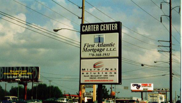
Carter Center (One Copenhill, 404-331-0296) - Jimmy Carter’s presidential library is served by the 16 bus.
Cyclorama at Zoo Atlanta (404-624-1071) and Zoo Atlanta (404-624-5600) (both in Grant Park)- The Cyclorama is
a Civil War-related artwork with hundreds of human-size toy Confederate and Union soldiers set against a 400-foot circular
painting of the Battle of Atlanta. Zoo Atlanta has been transformed over the past decade into one of the nation’s better
zoos. Both are in Grant Park, and are best served by the 31, 32 and 97 buses.
DeKalb Historical Society (101 East Court Square, 404-373-1088)- At Decatur station.
Fernbank Museum of Natural History (767 Clifton Rd, 404-370-0960) and Science Center (156 Heaton Park Dr, 404-378-4311)-
The largest museum of natural history south of Washington, D.C. is just off Ponce de Leon Avenue, served by the 2 bus. Fernbank
features an IMAX theatre, numerous exhibits and a botanical garden right next door.
High Museum of Art (1280 Peachtree St., 404-733-4444)- Just east of the Arts Center station, and also served by the
23 bus.
High Museum/Folk Art and Photography Galleries (30 John Wesley Dobbs, 404-577-6940)- In the rear of the Georgia-Pacific
Building, and across the street from the South exit of Peachtree Center station.
Margaret Mitchell House (990 Peachtree St., 404-249-7015)- This museum, dedicated to the life of Margaret Mitchell
(author of Gone With The Wind), is a block east of the Midtown station, and is served by the 10 bus.
Marietta Museum of History/Kennesaw House Museum (Marietta Square, 770-528-0431)- Served by 40 CCT bus.
Martin Luther King Center (449 Auburn Avenue, 404-526-8900) This museum, dedicated to the life and times of Martin
Luther King, is a few blocks north of the King Memorial station off Boulevard (and is also served by the 3 and 99 buses).
William Breman Jewish Heritage Museum (1440 Spring St., 404-873-1661)- Just two blocks north and two blocks west of
the Arts Center station’s western exit.
Woodruff Arts Center (1280 Peachtree St., 733-4200)- This massive structure, just east of the Arts Center station (and
also on the 23 bus route), is home to the Atlanta Symphony, the Atlanta Opera, the Alliance Theatre, the Alliance Children’s
Theater, and the Atlanta College of Art.
World of Coca-Cola (Central Ave. and Martin Luther King Drive, 404-676-5151)- This gaudy museum of Coca-Cola memorabilia
is just east of the Five Points station right next to Underground Atlanta.
Wren’s Nest (1050 Ralph David Abernathy Blvd, 404-753-7735)- The home of 19th-century writer Joel
Chandler Harris (author of the "Uncle Remus" stories) is served by the 71 bus and is only a 10-minute walk from the West End
station.
Centennial Olympic Park
(Marietta St. and Techwood)- From Omni station, walk two blocks northeast on
Techwood. From Peachtree Center station, walk three blocks west on International.
Chastain Park (bounded by Powers Ferry and Lake Forrest, just north of Putnam and south of Dudley)- Served
by 38 bus.
Grant Park (bounded by Sydney, Cherokee, Boulevard and Atlanta)--On the 31, 32, and 97 bus routes.
Piedmont Park (bounded by 10th Street, Piedmont Avenue, and Monroe Drive)-- Walk a block east
and south from Arts Center station to 14th St. and Peachtree, then walk two long blocks down 14th street
to Piedmont. Or, walk east on 10th Street from Midtown Station. This park is also served by the 36 bus.
Stone Mountain Park--This 3200-acre park is most known for the mountain itself, the world’s largest
mass of exposed granite. In 1970, the mountain was decorated with a 90-foot-by-190-foot bas-relief carving of Confederate
generals Robert E. Lee and Stonewall Jackson (as well as Confederate President Jefferson Davis). To reach the park, take the
118 and 120 buses to Main St. in downtown Stone Mountain, then walk several blocks east to the park entrance.
Woodruff Park (Peachtree Street and Park Place)--This park is at Atlanta’s true downtown core,
between Five Points and Peachtree Center stations. From Five Points, walk a couple of blocks north on Peachtree; from Peachtree
Center’s southern exit, walk a couple of blocks further south.
SPORTS ARENAS
Alexander Memorial Coliseum
(Georgia Tech’s sporting arena)-- From Midtown station, walk several
blocks west on 10
th St. bridge. Alternatively, take 12 and 37 buses.
Georgia Dome (1 Georgia Dome Drive, 404-223-8687). Gate D of this stadium, home of the Atlanta Falcons,
is connected to the Omni/Dome station by a covered walkway.
Grant Field (Georgia Tech’s football stadium)-- Go to North Avenue station, walk several blocks
west on North Ave.
Phillips Arena (100 Techwood Drive)--This arena, home to the Atlanta Hawks and Atlanta Thrashers, is
at the Omni/Dome station.
Turner Field (755 Hank Aaron Drive, 404-614-2311)-- To reach the home of the Atlanta Braves, take the
Braves Shuttle from Five Points station. Or if you don’t mind walking along a multi-lane road in a nondescript area,
walk four blocks south from Georgia State station.
Although some of the stadiums listed above have no telephone numbers, you may wish to call the sports teams
(or, in the case of college stadiums, the general Georgia Tech phone number) for information about game times, etc.
COLLEGES AND UNIVERSITIES
In addition to being served by MARTA, the larger colleges in Atlanta (such as Georgia State, Emory and Georgia
Tech) have internal shuttles serving the campuses themselves and, in some cases, MARTA rail stations. Contact the colleges
for details.
Agnes Scott College (141 E. College Ave. in Decatur, 404-471-6000- contact student life office)- Discounted
monthly MARTA passes are available ($37.00). Shuttle service is provided Monday-Friday around campus, to bus and train lines
and Saturday around Atlanta. To get to Agnes Scott, go to Decatur station, then walk several blocks south on Church St. to
College Avenue (the college’s northern boundary). Or take bus 15 or 18 from Decatur station.
Atlanta College of Art (1280 Peachtree, 404-733-5001)- Served by the 23 bus, and only a block from the
Arts Center rail stop.
Atlanta Area Tech (1560 Stewart Avenue SW, 404-756-3700-contact the student life office)
Atlanta Metropolitan College (1630 Metropolitan Pkwy SW, 404-756-4358)- served by 95 bus running from
West End station. Offers discounted monthly MARTA passes.
Clark Atlanta University (James P. Brawley Drive and Fair Street, 404-880-8000)- Offers discounted monthly
MARTA passes. Atlanta University Shuttle service runs Monday-Friday from campus to campus (including, Spellman, Morehouse,
Clark Atlanta, and Morris Brown). To get there take MARTA rail to Vine City station, and walk a block south to Martin Luther
King to find the northern fringe of this campus. Served by the 13 bus.
Clayton College and State University (5900 North Lee St. in Morrow)- Served by 501 and 502 C-TRAN routes.
Columbia Theological Seminary (701 Columbia Drive in DeKalb County, 404-378-8821)- On Columbia Drive,
served by the 96 bus.
DeKalb Tech (495 N. Indian Creek Drive in DeKalb County, 404-297-9522) & Georgia Perimeter College,
Clarkston Campus (555 N. Indian Creek Drive, 404-299-4000)- These neighboring campuses are served by the 122 and 125 buses.
DeVry Institute of Technology (250 N. Arcadia Drive in Decatur, 404-292-7900)- A short (1/4 mile) walk
north of Avondale station on Arcadia, and served by the 75 bus.
Emory University (1389 S. Oxford Rd., 404-727-6201)- Offers discounted monthly MARTA passes and 24-hour
shuttle service throughout campus. Get there by the 6, 36 and 245 buses.
Georgia Institute of Technology, a.k.a. Georgia Tech (225 North Ave. NW, 404-894-2800)-Offers discounted
monthly MARTA passes and a shuttle to and from nearby MARTA rail stations. Georgia Tech’s sprawling campus is within
walking distance of two rail stations. To reach Georgia Tech’s northern fringe, go to Midtown station and walk several
blocks west on 10th St. bridge. To reach Georgia Tech’s southern fringe, go to North Avenue station and (a)
walk several blocks west on North Ave. bridge. In addition, the Georgia Tech campus is served by the 13, 37 and 98 buses,
as well as by a Georgia Tech internal shuttle.
Georgia State University (404-651-2000/ 404-651-2150)- GSU is spread through downtown Atlanta. Most of
GSU, however, is between the Five Points and Georgia State rail stations, and is served by the buses serving the east side
of downtown Atlanta (especially the 1, 4, 17, and 186 buses).
Georgia Perimeter College has several campuses in addition to the South DeKalb campus listed above. Its
Decatur campus at 3251 Panthersville Road (404-244-5090) is served by the 114 bus. Its Dunwoody campus, at 2101 Womack Road
(770-551-3000), is right off Tilly Mill Road in Dunwoody, served by the 132 bus.
Kennesaw State University (1000 Chastain Rd. in Cobb County, 770-423-6000)- Offers discounts on transit
passes. Served by the 40 and 45 CCT buses.
Mercer University (3001 Mercer University Drive, 770-986-3000)- Served by the 126 bus.
Morehouse College (830 Westview Drive SW, 404-681-2800) and Spelman College (350 Spelman Lane
SW, 404-681-3643)- These campuses are between the West End and Ashby stations; Morehouse is about a half mile from each. From
Ashby, walk south on Ashby to Fair Street. From West End, walk north on Lee until you reach the campus. The Morehouse School
of Medicine is closer to West End off Lee, while Spelman is between the main Morehouse campus and the medical school.
Morris Brown College (643 Martin Luther King Jr. Drive NW, 404-220-0270)- Offers discounted monthly MARTA
passes and shuttle service to MARTA bus and rail. Just a block west of the Vine City rail station. Best served by the 13 and
51 buses.
Oglethorpe University (4484 Peachtree Road, 404-261-1441)- Offer discounted monthly MARTA passes and
shuttle service from campus to MARTA (Monday-Friday 7:30-10:00 AM., 1:30-5:00 PM). Located about a 2/3 mile walk north of
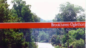
the Brookhaven rail station. Also served by the 25 bus.
Southern Polytechnic State University (1100 S. Marietta Parkway in Marietta, 770-528-7200)- Served by 10 CCT bus. Also
a block away from Marietta transfer center, served by 10C, 15, 20, 30, 40, 45, 50, 65 and 101 CCT buses.
OTHER ATTRACTIONS
Americasmart
, a.k.a. Atlanta Merchandise and Apparel Mart (240 Peachtree Street, 404-220-3100)- Just
west of Peachtree Center station; also served by 10 bus.
Amtrak station (1688 Peachtree St, 1-800-USA-RAIL)- Served by 23 bus from Arts Center Station.
Atlanta Civic Center (395 Piedmont Avenue, 404-658-7159)- This popular site for theatrical and musical
performances is just east of the Civic Center station, or take 16, 31 or 46 buses.
CNN Center (1 CNN Center at Marietta St., 404-827-2300)- Just northeast of the Omni station; offers a
tour of the CNN studios.
Central Atlanta Public Library (1 Margaret Mitchell Square, 404-730-1700)- One block west of the Peachtree
Center station’s southwest corner.
Ebenezer Baptist Church (407 Auburn Avenue, 404-688-7263)- Where Martin Luther King and his father preached.
A few blocks north of the King Memorial station off Boulevard, and also served by the 3 bus.
Georgia State Capitol Building (206 Washington St., 404-656-2844)- A block south of the Georgia State
station. Served by the 10, 31, 74, 97 and 106 buses.
Georgia World Congress Center (285 International Blvd., 404-223-9200)- At Omni/World Congress Center
station.
Greyhound bus terminal (232 Forsyth St SW, 1-800-231-2222)- At Garnett rail station.
Hartsfield Airport- at Airport rail station.
HiFi Buys Amphitheatre (2002 Lakewood Ave, 404-627-9704)- Take shuttle from Lakewood station during concert
season.
Oakland Cemetery (404-688-2107, bounded by railroad tracks, Boulevard, Oakland and Memorial)- Oakland
is Atlanta’s most historic cemetery, and contains the remains of Margaret Mitchell, 3000 Civil War casualties, legendary
golfer Bobby Jones, and most of the city’s 19th-century elite. From the King Memorial station, walk a block
south on Oakland. Also served by the 18, 21, and 32 buses.
Six Flags over Georgia (7561 Six Flags Rd in Austell, 770-739-3400)- Served by 201 bus.
The Varsity (North Ave. at Spring St.)- This Atlanta classic is one of the world’s largest (if
not the largest) fast-food restaurants; it is unusual because of its hot dogs, onion rings, and its numerous TV rooms (including
one devoted to CNN). It is a block west of the North Avenue station.
CHAPTER SIX: ATLANTA’S NEIGHBORHOODS
Only in the loosest sense of the word can Atlanta be characterized as a "city." Even at its intown core, Atlanta is and
always has been a collection of distinct communities. Unlike other cities, the cultural and economic life of Atlanta has never
been concentrated in a single hub, but instead it has been dispersed across many different areas. So while the region has
certainly been sprawling at an unprecedented rate over the past 20 years, to some extent Atlanta has always been a place where
the whole is somewhat less than the sum of its parts.
That said, those parts are becoming better and better every year, and particularly in the core "intown" area within Fulton
and DeKalb Counties. While Atlanta’s 13-county metropolitan area continues to sprawl, the intown neighborhoods have
become more desirable in recent years. People are tired of the traffic and complete auto-dependence that comes with a home
in the outlying suburbs. Fortunately, intown Atlanta has many great options to offer those who are seeking a better quality
of life: a rapidly growing number of lofts and condominiums in downtown, midtown, and prestigious Buckhead; and many lovely
homes in historic, walkable communities.
Although Atlanta is notoriously forward-looking and eager to destroy any building that is older than 30 years,
many of Atlanta’s historic neighborhoods have escaped this misfortune. In fact, intown Atlanta is blessed with an extraordinary
variety of old homes and architectural styles. While real estate values are rising rapidly, Atlanta is still less expensive
than San Francisco or New York.
The trade-off is that Atlanta does not yet have all the nearby amenities of these cities. Whether it is intown or metropolitan
Atlanta, almost everyone who moves here brings at least one car with them, and all the extra costs that a car entails. Even
in intown Atlanta, there are few residential areas within convenient walking distance of the nearest supermarket. Nonetheless,
it is possible to live in Atlanta, and almost fully enjoy everything it has to offer, without owning a car. If you want to
go car-free, or at least car-light, this chapter will offer you some tips on where you can live and what you can do.
This chapter divides neighborhoods into six categories: Downtown, Northeast, Northwest, Southeast,
Southwest; and other suburbs. Within the city of Atlanta, city streets are officially designated as falling within one
of these four quadrants. Where neighborhoods straddle the east-west line, such as in Buckhead, we have chosen to place
those neighborhoods in the "Northeast" category, since the eastern halves of those neighborhoods tend to be more walkable
and more lively. In placing suburbs within the quadrants, we have chosen the following criteria: (1) suburbs in DeKalb
County are eastern, while those in Fulton and Cobb Counties are western, and (2) suburbs north of downtown Atlanta are northern,
while those south of the city are southern. For example, South Fulton suburbs such as East Point are in the Southwest
quadrant (because they are south of downtown and in Fulton County).
In most of the second half of the 20th century, the north side (in city and suburb alike) was white, rich
and booming (except for the city's industrial belt in the far northwest and a few eastern neighborhoods bordering the north
and south sides, such as Inman Park and Virginia-Highlands). The south side, by contrast, was poor, African-American and
declining.
But these boundaries have started to blur in recent decades. Over the past decade, many southside neighborhoods
have started to improve- especially areas in the southeastern part of the city, such as Grant Park and East Atlanta.
Northside neighborhoods, while still wealthy and majority white, are more racially integrated than they once were, as Atlanta's
black community has become more affluent.
We have rated these neighborhoods from 0-4 stars based on their pedestrian- and transit-friendliness. All of the neighborhoods
have their virtues and disadvantages, but our sole interest is in how easy, or difficult, it is to live in them without having
to depend on a car.
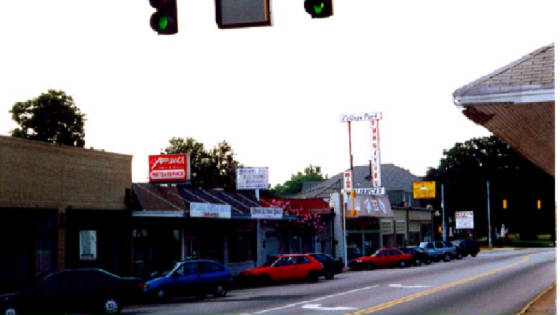
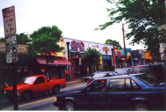
DOWNTOWN: THE BEGINNING OF RESURGENCE (3.5 Stars)
Buses
: 1, 3, 4, 9, 10, 11, 13, 16, 17, 21, 31, 42, 49, 55, 72, 74, 97, 186
Rail: Omni, Georgia State, Five Points, Peachtree Center, Civic Center, Garnett
Sidewalks: Always
For most of the 1970s and 1980s, Atlanta’s central business district experienced the slumps common
to many downtown areas. But over the past decade, downtown Atlanta has made an impressive recovery. In downtown’s main
commercial streets, the population more than doubled between 1990 and 1999. Downtown’s small number of high-rise condos
is more expensive than ever, and once-vacant office space above businesses is being converted to loft housing. Downtown rents
are as high as those in Midtown and Buckhead. Most housing in the area is in smaller loft buildings. To look for downtown
housing, you can either walk around downtown looking for it or consult Central Atlanta Progress’s Housing Directory
(available online at http://www.centralatlantaprogress.org/LivingHere_Housing.asp)
Safety is still a concern, but to a lesser extent than a decade or two ago. Downtown’s private "Ambassadors"
– you will know them by their white helmets and friendly dispositions – have been instrumental in making the area
safer and more enjoyable. The general rule in downtown Atlanta is that the safest areas are the busiest ones: Peachtree Street
(the area’s commercial hub) between Baker Street and Five Points (the area’s transit hub) and the Fairlie-Poplar
district, a low-rise area just west of Peachtree near the Peachtree Center rail stop. By contrast, the blocks near the Civic
Center and Garnett stations are pretty deserted.
Each part of downtown, indeed each train stop, has its own personality.
Five Points is downtown’s traditional hub, and is still very lively during the daytime, with plenty
of small street-level shops.
The Peachtree Center station is a tourist attraction in itself; it was carved out of solid rock, and the
subway tunnel is made of gneiss rather than being paneled over with tile. The Peachtree Center area is the part of downtown
most favored by upscale law firms and similar businesses, and is less deserted than most of downtown after dark.
The Omni stop is dominated by the CNN Center and Centennial Park, gleaming, clean, and a bit sterile. However,
the loft-dominated, once-industrial Castleberry Hill neighborhood begins a couple of blocks south of Centennial Park.
The area near the Georgia State stop is dominated by the Georgia State campus.
Civic Center and Garnett have fewer points of interest. However, the Garnett stop does have the Greyhound
Bus Terminal, and there is a great deal of development planned around Civic Center, such as a children’s museum and
new condominiums.
The best thing about living downtown is that a wide range of amenities are within walking distance –
and because all three train lines meet at the Five Points rail stop, transit-accessible amenities outside downtown can easily
be reached. The Five Points station has a transit store and maps for every bus route in the city. Downtown attractions include
Underground Atlanta, Centennial Olympic Park, and the city’s sports arenas (Turner Field, Philips Arena, the Georgia
Dome). More information about these as well as other downtown amenities may be found in the previous chapter.
Adjacent to downtown, the Auburn Avenue district – once the commercial core of Atlanta’s African-American
community -- is now experiencing a renaissance of its own. Just a few blocks east of Five Points, this area contains several
noteworthy attractions, including the APEX Museum, the Ebenezer Baptist Church, and the Martin Luther King, Jr. Center for
Non-Violent Social Change. You can take a guided tour of the childhood home of Dr. King at 501 Auburn Avenue. The Sweet Auburn
Curb Market at 209 Auburn Avenue has a range of tasty food. In addition to rail stations at Five Points and King Memorial,
Auburn Avenue is served by the 3 and 99 buses.
NORTHEAST
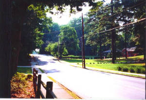
Ansley Park: The Best of Both Worlds (3 Stars)
Buses
: 23, 36
Rail: This area begins a block south of the Arts Center station.
Sidewalks: Nearly always
Like several other intown neighborhoods, Ansley Park was developed as a streetcar suburb in the late 19th century.
It has some of the loveliest and most expensive homes in the city, along winding and thickly forested streets. In terms of
walkability, and access to recreation, shopping and work areas, Ansley Park is near the top of the list among Atlanta neighborhoods
(if you can afford it). In a neighborhood just a few blocks wide, Ansley Park has five small parks -- not counting Piedmont
Park, a large park bordering Piedmont at the neighborhood’s eastern edge. The neighborhood begins just east of Peachtree
Street and midtown, one of Atlanta’s major office corridors as well as its cultural center. Ansley Park is also a great
area for bicycling, with wide streets, slow-moving cars, and a bike lane along its main road, Peachtree Circle (not to be
confused with Peachtree Street).
Because the Arts Center train stop and the 23 bus run up and down Peachtree Street, auto-free Ansleyites have access to
all of the amenities of Buckhead and downtown. The train can take you to downtown and lower midtown. During rush hours, the
23 bus consistently runs about every five or ten minutes between Arts Center and Lenox Mall, making bus use relatively convenient
for Ansleyites and other residents along the Peachtree corridor.
Ansley Park’s major shopping area is Ansley Mall, a strip center at the neighborhood’s northeast end on 1544
Piedmont. However, Ansley Mall’s bus service is not as good as Peachtree Street’s: the only bus going from the
Arts Center station to Ansley Mall, the 36 bus, stops running at around 8 PM.
Ansley Park does have a couple of imperfections from the pedestrian perspective. For a visitor, Ansley Park’s confusing
maze of streets requires a map. There are no square blocks, no straight avenues, no apparent pattern to the area’s winding
lanes, which invite even the most careful pedestrian to get lost. Second, the nearest commercial street, Peachtree, is not
the most pedestrian-friendly commercial street; it is six lanes wide and its traffic moves quite fast.
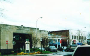
Avondale Estates (3 Stars)
Buses
: 121, 122.
Rail: None inside city, though the Kensington stop is a block east of the Avondale city limits and the
Avondale stop is seven blocks west of the city limits.
Sidewalks: more often than not, especially in city’s northern half near commercial center on Avondale
Road.
Decatur and Avondale Estates are more similar than different: both are antique, pedestrian-friendly suburbs
with downtowns dominated by narrow streets and small businesses, and residential streets that are just a short walk from those
downtowns. Even so, the two suburbs do have significantly different personalities. Decatur is lively and diverse, with a much
larger commercial area. Decatur also has rail service. By contrast, Avondale Estates’ commercial street, Avondale Road,
is tiny and sedate, and the area is more socially homogenous and family-oriented.
Avondale Estates was founded in the 1920s by one developer, patent medicine millionaire George F. Willis.
Because Avondale Estates reflects one man’s vision, its housing stock is far less diverse than that of most Atlanta
suburbs: 88% of Avondale housing consists of single-family homes (as opposed to 65% in Decatur).
Avondale Estates’ most noteworthy feature is its commercial area on Avondale Road: a row of Tudor-style
buildings created to simulate an English village. The city also has two parks reserved for the use of Avondale Estates residents.
There is a train stop called Avondale, but do not be fooled: it is not in Avondale Estates, and is in fact
no closer to the commercial area than is the Kensington stop. Both the Avondale and Kensington stops are in somewhat seedy
areas, so if you are going to Avondale Estates after dark you may feel safer using the 121 and 122 buses, both of which go
to Avondale Road.
Buckhead's neighborhoods
This web page focuses on Buckhead neighborhoods east of Peachtree; Buckhead west of Peachtree
(except for the area's western fringe on Howell Mill Rd.) is almost entirely dominated by single-family homes, has minimal
bus service (except for the 12 bus running up and down Howell Mill), and has almost no sidewalks on residential streets (with
a few magnificent exceptions such as Peachtree Battle Avenue).
Buckhead Village (3 stars)
Buses
: 23, 38, 44
Rail: Buckhead Station
Sidewalks: Consistently
The center of Buckhead Village is at the intersection of Peachtree Road, Roswell Road and West Paces Ferry
road. The Village extends along these roads and Pharr road in each direction and is bounded by Piedmont Road to the north
and east and by East Wesley and West Wesley Roads to the south.
Buckhead Village is organized around the extant buildings that were built at Peachtree and Roswell Roads
during the railcar era. Those on foot can reach a wide variety of shops, restaurants and bars from this intersection. Walking
up and down Peachtree and along the side streets is safe if not pleasant, and numerous condos and apartments are very close
to the action. Despite the number of cars that come through and to this area, most of the buildings are very close to the
street and accessible to pedestrians. At night, because of the bars, Buckhead Village is one of the most active pedestrian
environments in the city.
Automobile traffic moves slowly in the area because of the congestion and the number of traffic signals.
On Peachtree Road, the lack of turn signals causes some conflict at the intersections and there is otherwise a lot of lane
changing and jockeying going on. Most of the other streets remain relatively quiet.
For most of the past half century, Buckhead has been known throughout the Atlanta region as the ritziest
neighborhood in the city. However, there are also some housing choices for middle-income types. There are quite a few apartments
and a limited number of affordable condos in the immediate area of the village. All types of apartments can be found. Most
condos are in the $300,000 to $1,000,000 range, but there are a few converted apartment buildings that go for $250,000 and
under.
The Buckhead rail station is just under one mile from the intersection of Peachtree Road and Roswell Road.
Although there is no rail station in the immediate vicinity of the village, bus service to the district is good. The main
route is the 23, which runs up and down Peachtree frequently until midnight.
Lenox: Urban but barely Walkable (2.5 Stars)
Buses
: 23, 25, 47, 48 (plus "Buc Ride" shuttle)
Rail: Lenox, Buckhead
Sidewalks: Usually
The Lenox area, so named because of Lenox Road and Lenox Square Mall, includes the retail and commercial
buildings along Peachtree Road from Piedmont Road to Peachtree-Dunwoody Road and along Lenox Road from Peachtree to Lenox
Station. The Lenox area was definitely not planned for the pedestrian, but the amount of goods and services within the walkable
area around the intersection of Lenox Road and Peachtree Road is significant. Although this particular intersection is very
dangerous to cross, it is both easy, and sometimes even pleasant, to move up and down Peachtree and Lenox Roads. Getting from
Lenox Square Mall to Phipps Plaza is easier than it seems and, as in other places nearby, it is sometimes necessary to cut
across parking lots to make walking trips efficient.
Lenox is known mostly for shopping. There are two malls and a few smaller shopping centers. This part of
Buckhead is also a center for finance and real estate firms. The office market is well established and currently booming.
The one shortcoming to date for the Lenox area has been the lack of residential units for rent or for purchase. This is starting
to change, but most of the new apartments and condominiums are quite expensive. They also tend to be located near large parking
lots, office buildings, and Georgia 400—hardly an ideal setting. At its worst, the Lenox area is ‘intown’
but not ‘urban’ because of the automobile-oriented development.
Lenox Square Mall is the oldest shopping mall in the city, although you would never know it given the number
of upgrades and the amount of money spent on upkeep. Lenox and Phipps Plaza draw people from throughout the region and are
a primary destination for visitors to the city. Phipps Plaza is more upscale, but Lenox has its share of high dollar items
as well. Between the two, the mall shopping experience is complete. There are also some recent and significant additions to
the base of retail around Lenox. Just north of Lenox Road, on Peachtree Street, is a new shopping center with Target, a grocery
store, a sports equipment store and a Staples office supply store.
Although Lenox is not known for food, nightlife and entertainment, there are several places to enjoy each.
One of the best-known and longest-standing establishments is Dante’s Down the Hatch, where the fondue is not cheap,
but the live jazz and atmosphere make it nice for a special occasion. Maggiano’s is a relatively new Italian restaurant
right next to Buckhead Station that is establishing itself as an Atlanta standard by bringing in shoppers, visitors and intown
residents as well. Lenox and Phipps both offer food courts, Lenox being the better of the two. Lenox also has an unusual concentration
of Japanese restaurants. Hashiguchi Jr., literally in Around Lenox, is hidden away but well known and very busy. Tower Place
is home to Rusan’s, another sushi-oriented Japanese restaurant.
If you are looking for the Buckhead bar scene, Lenox is definitely not the place to go. There are a few restaurants
and bars in or near the malls that range from low-key to upscale, but none stand out as entertainment venues. Most of the
people who come to the area for entertainment come for the movies. Both Lenox and Phipps have multiplex theaters.
There are two rail stations that serve the Lenox area: Buckhead at the south end on Peachtree Street and
Lenox Station, on Lenox Road, just east of Peachtree. These two stations are within a half-mile of the intersection of Peachtree
Road and Lenox Road. Bus service to the district is good.
In addition to being served by MARTA buses and trains, Lenox also has a neighborhood shuttle called "the
Buc" (www.bucride.com) that serves the neighborhood, running from the intersection of Peachtree and Piedmont on the south
to Phipps Plaza on the north. The Buc serves a variety of destinations, including the Lenox and Buckhead MARTA
stations and the Lenox and Phipps Plaza malls. The Buc is free and runs from 7 AM to 10 PM, every 8-15 minutes.
South Buckhead (3 Stars)
Buses
: 5, 6, 23, 27, 30, 33, 38, 39, 44 and 245 buses. Also, the Buford Highway Royal Bus Lines
bus (discussed in more detail in the Chamblee/Doraville section below) begins at the Lindbergh MARTA stop in South Buckhead.
Rail: Lindbergh Center Station
Sidewalks: Usually
South Buckhead is the area north of Buckhead Village, south of Midtown, and between Piedmont Road and Peachtree
Road. On Peachtree, it runs roughly from the Amtrak station near Midtown to Lindbergh Drive and on Piedmont it runs from the
I-85 underpass to Pharr Road. South Buckhead is not very well known among most Atlantans. In fact, the area is not usually
thought of as Buckhead at all. When people think of Buckhead, they usually conjure up images of Lenox Mall, Phipps Plaza,
the Buckhead financial district, and the very popular shops and restaurants of Buckhead Village. South Buckhead is often conceived
of in terms of its constituent parts: Lindbergh Center and Peachtree Road. With respect to getting around the area without
a car, it is best to talk about it in these terms as well.
The main transportation routes in the area are Piedmont Road, Peachtree Road, Lindbergh Drive and Peachtree
Hills Avenue. Lindbergh Center MARTA Station is on the corner of Piedmont and Lindbergh Drive and is one of the busiest on
the system. This is because the station is a bus hub, a commuter park-and-ride facility, and because there are many people
who walk to and from the station. Peachtree Road is served by the 23 bus in this part of town. The Peachtree corridor in South
Buckhead is a viable place to live in and use without a car because of the 23.
In general, the pedestrian environment is good on Peachtree Road and not so good on Piedmont Road. Peachtree
Road, between Brookwood Station and Lindbergh Drive, is hospitable to pedestrians for a number of reasons. There are no major
cross-streets and thus no daunting intersections. In addition, most buildings have a street-oriented presence and scale or
are at least close to the street. The only drawback is that traffic moves a little bit quicker here than on other parts of
Peachtree, but there are plenty of opportunities for signalized crossings. On Piedmont Road, between the I-85 underpass and
Pharr Road, the roadway and the buildings are clearly designed for automobile travel and access. Crossing can be dangerous,
but there are usually enough people coming to and from Lindbergh Center Station to alert drivers to the presence of people.
The portion of Lindbergh that runs between Piedmont and Peachtree is far less hospitable for pedestrians due to the absence
of sidewalks on most of this part of Lindbergh.
South Buckhead’s two major commercial districts are Lindbergh Center and the stretch of Peachtree Road
from Brookwood Station to Peachtree Battle Shopping Center. The commercial development along Peachtree Road is heavily oriented
towards restaurants and specialty stores and has little discount merchandise- facts that do not keep Peachtree Battle Shopping
Center from being very popular and busy. It is between Lindbergh Drive and Peachtree Hills Avenue and is accessible by bus
on the 23 or the 44. There are no other major shopping destinations along this stretch of Peachtree, but there are a few highlights
to the south that can either be walked to or reached on the 23 bus.
The Lindbergh Center area, by contrast, has historically been more "big box" and discount-oriented, and has
historically drawn shoppers from throughout the city. However, the Lindbergh area is undergoing redevelopment, and so may
be unrecognizable in a few years.
Most of South Buckhead's apartments and condos are either on, are within a block of, Peachtree and Piedmont.
The majority of South Buckhead's side streets are devoted to single-family houses. South Buckhead's single-family blocks
vary dramatically in pedestrian-friendliness. The blocks just east of Peachtree and south of Collier (generally known
as Brookwood Hills) nearly always have sidewalks, and are among Atlanta's most desirable blocks. Areas further north
and west are less likely to have sidewalks.
Most of the houses in South Buckhead are fairly expensive by Atlanta standards. Even the smallest of homes
are hard to find for a price under $300,000 and most hover around $500,000. Despite the cost of houses, the rental market
and condo market in South Buckhead are quite reasonable compared to the up-and-coming "intown" residential areas just to the
south. There is a wide variety of living options with regard to both price and quality. Lindbergh has very affordable places
to live to the east of Piedmont and more expensive places to the west, all within a short walk to the station. It is host
to several apartments and condos, and there are several residential projects under construction right around the station.
In fact, the site of the station itself is now being developed as a mixed-use center with office, retail and residential buildings
and should be completed within the next few years. To the west of Piedmont Road along Lindbergh Drive and Peachtree Hills
Avenue there are numerous apartments and condos that have very good access to Lindbergh and to Peachtree Road. Peachtree Road
itself offers many places to live. As a general rule, they get more expensive as you get closer to Buckhead Village and less
expensive as you make your way south through Brookwood.
Brookhaven (2 Stars)
Buses
: 8, 19, 25, 41, 70, 91
Rail: Brookhaven
Sidewalks: Present in most areas, but not all
The MARTA rail station at Brookhaven is at the center of the Brookhaven neighborhood. There are many shops,
restaurants and amenities within a short walk of the station including a major grocery store, pharmacy chain store, a medical
center (Piedmont Medical Care Center) and banks. The main obstacle standing between the rail station and these amenities is
Peachtree Road, a six-lane road with a 45 mph speed limit that appears to be exceeded by everyone. Although there are adequate
crosswalks and sidewalks on this road, it is a rather hostile environment for the pedestrian and bicyclist. Walking around
the Brookhaven area is more reminiscent of the suburbs, with its maze of disconnected streets, than an intown neighborhood
situated on a grid street system. But at the same time there is a well-intact canopy of old trees, which lend shade, helping
one avoid feelings of being totally misplaced.
Just up the road from the station, at Osborne Road, is the DeKalb Services Center where Brookhaven Park is
situated. Complete with picnic shelters, ball fields and a nice wooded walking path, the park sits disconnected and underutilized
by the many surrounding residents (some overlooking the park) whose access is limited to one gate at far northern side. Further
down Osborne road there is Lynwood Park, complete with swimming pool.
Brookhaven has a good mix of housing options. The wealthier side tends to be that west of Peachtree Road
while the older, more modest sections tend to be east of Peachtree Road. However, new developments of $500,000 McMansions
seem to be popping up on both sides, blurring the distinction between the two sides. There is also a smattering of apartment
complexes in the Brookhaven area including Post Glen Apartments -- just a 5-minute walk from the turnstiles of the
MARTA rail station.
Candler Park/Lake Claire: Quiet Intown Suburb with an Edge (3.5 Stars)
Buses
: 3,6,17,18, 28, 123
Rail: Edgewood/Candler Park
Sidewalks: Most streets have sidewalks that were laid decades ago. Most of these sidewalks are in disrepair
from root-upheavals and sink holes.
Founded as a streetcar suburb named Edgewood in 1890, Candler Park has seen periodic episodes of decay, but
is now one of Atlanta's hottest places to live intown (a fact which is clearly reflected in the value of homes in the area).
Candler Park is a suburb of old; its development pattern is based on a streetcar line that ran the length of McLendon Avenue.
As a result of this "traditional" development pattern, it is a very walkable neighborhood where you always have an alternative
route in the grid. Being a neighborhood, and not a town in itself, Candler Park has no real center where one can walk to do
food shopping or other errands. However, it is flanked by two small commercial areas. On the east, at Clifton Road, there
is a small commercial area straddling McLendon Avenue where one can walk to one of several restaurants, pick up groceries
at the Candler Park Market, buy that hard-to-find record at Full Moon Records, or search for that unusual gift at one of the
several specialty shops. On Candler Park's western border, which is Moreland Avenue, there is a larger commercial area known
as Little Five Points. Being the congregation point for many of Atlanta's bohemians, Little Five Points offers an interesting
contrast to the serene, residential streets of its bordering neighborhoods (Candler and Inman Park). No more than a mile walk
from anywhere in the Candler Park neighborhood, Little Five Points offers entertainment (Variety Playhouse, 7 Stages) plenty
of interesting specialty shops and restaurants, two natural food stores, a post office, a bike shop and a home furnishings
store.
Getting to and from Candler Park via public transit is not only possible, but very convenient. The Edgewood/Candler
Park train station is no more than a 20-minute walk (in most cases 10 minutes) from anywhere in Candler Park. Situated on
the east/west line, trains from this station can bring you west to Five Points downtown in less than 15 minutes and east to
Decatur in 10 minutes.
It's ironic that an intown neighborhood such as Candler Park offers more public greenspace than the spacious
suburbs outside the perimeter. The park that gives Candler Park its name offers a 9-hole golf course, swimming pool, tennis
courts, and open sports fields. The PATH bike trail passes through Candler Park, creating a greenway between Oakdale Avenue
and North Highland Road. On a typical evening or weekend, the greenway teems with joggers, bikers, rollerbladers and dog walkers.
From the PATH you can continue your walk/jog/bike ride through the shady streets of the bordering neighborhood, your imagination
being stimulated by the turn-of-the- century architecture of the houses.
Just east of Candler Park is Lake Claire. Like Candler Park, Lake Claire is a relatively diverse intown neighborhood
with a healthy mixture of young and old, empty-nesters, young families, and singles. Prices are comparable to Candler Park,
and higher than Kirkwood to the south. While there is in fact no lake in Lake Claire, the neighborhood is one of the most
peaceful urban enclaves intown. However, you won’t find many pedestrians in Lake Claire simply because there are not
many places to walk to, except for the McLendon Avenue commercial district and Lake Claire Park. But the sidewalks are in
good condition and, if you like to bicycle, the roads are safe if somewhat narrow.
Chamblee/Doraville: Atlanta’s Chinatown (2 Stars)
Buses
: 25 (Chamblee only), 29 (Chamblee only), 33 (Chamblee only), 39, 70 (Chamblee only), 91 (Doraville
only), 103 (Chamblee only), 104 (Doraville only), 124, 126 (Chamblee only), 132, Royal Bus Lines
Rail: Chamblee, Doraville
Sidewalks: Rarely
Most larger, older cities have a Chinatown: a small, tight-knit urban neighborhood dominated by recent Asian
immigrants. Atlanta has nothing like that. Instead, it has Chamblee and Doraville, two sprawling working-class suburbs dominated
by recent immigrants from Asia and (to a lesser extent) Latin America. Many Atlantans visit Chamblee and Doraville to soak
in Asian food and culture. The Chinatown Mall (5389 New Peachtree Rd.), just a couple of blocks north of the Chamblee rail
stop, contains two white-tablecloth Chinese restaurants, a food court with several fast-food Chinese restaurants, an Asian
grocery, and a Chinese bakery. The restaurants are not limited to the Americanized foods available at Chinese restaurants
throughout Atlanta, but also boast more exotic entrees like Mongolian venison.
The other major attraction in this area, Buford Highway, runs from Buckhead through Chamblee to Doraville,
although the largest concentration of interesting restaurants and markets is at the Doraville end of the highway. Buford Highway
contains too many Chinese and Korean markets, restaurants and bakeries to count, as well as the occasional Malaysian or Hispanic
restaurant. Especially noteworthy are Little Szechuan (5091-C Buford Highway 770-451-0192), one of the area’s most interesting
and best Chinese restaurants, Santo Domingo (5310 Buford Hwy., 770-452-3939), specializing in the foods of the Dominican Republic
(including goat stew), and the Buford Highway Farmers’ Market (5660 Buford Highway, 770-458-2296), which is not a farmers’
market at all but a huge supermarket specializing in every manner of Asian and Hispanic food. Buford Highway is served by
the 39 bus south of the Doraville rail stop, and by the 91 bus north of the stop. (The rail stop is south of the Farmers’
Market but north of nearly everything else.)
Nearly all of this area’s immigrant culture is east of the rail stops. West of the Chamblee rail stop
is a small, slightly rundown district of antiques stores.
Although Chamblee and Doraville have ample public transit, the pedestrian environment is one of the worst
in metro Atlanta. Buford Highway itself is a six-lane highway with almost no sidewalks. But many of its residents do not own
cars and walk there, and have worn a dirt path through the grass. One or two blocks have shrubbery and hills where the grass
should be, forcing people to either be very agile or risk it all by walking on Buford Highway itself. The residential blocks
almost never have sidewalks.
In addition to being served by the 39 bus, Buford Highway also has a private bus service: Royal Bus Lines,
which runs from the Lindbergh MARTA station to the Doraville MARTA station. Royal's 20-seat minibuses run every 10 or
12 minutes from 4:30 AM to 8 PM, and cost a quarter less than MARTA buses. Royal drivers pick up anyone they see waving
in their direction, and make change for riders (unlike MARTA drivers). But riding Royal has some disadvantages: the
buses don't run as late, the fare does not include subway transfers. Royal may expand service beyond Buford Highway
next year.
Decatur: The Transit-Friendly Town (3 Stars)
Buses
: 2, 8, 15, 17, 18, 22, 24, 36, 75 , 96, 120, 121, 123, 125
Rail: East Lake (on western fringe of city), Decatur, Avondale (on eastern fringe)
Sidewalks: Consistently
Both Decatur and Marietta are old cities that once rivaled Atlanta, although they have long since been absorbed
into metropolitan Atlanta’s economy. Both have historic and genteel town squares, and they remain the county seats for
DeKalb and Cobb counties, respectively. But there the resemblances end. Decatur has much more to attract the walker and transit
rider than Marietta. First of all, the area surrounding the town square (at the Decatur rail stop) is more developed than
the area around the Marietta square. There are more restaurants, more coffee houses, more of everything. Second, the area
surrounding the town square is transit-friendly. To get to Decatur from downtown Atlanta, all you need do is go to Five Points,
take a train – and in fifteen minutes you are there. By contrast, getting to downtown Marietta from the city by transit
is time-consuming and incovenient. In addition, Decatur is served by numerous MARTA bus routes.
Third, even if you don’t live in the heart of Decatur you can use trains, buses and your feet regularly
rather than being as dependent on a car as you would be in most Atlanta suburbs. The city’s western end is served by
the East Lake MARTA station, and its east end is served by the Avondale station. The blocks just north of both stations, although
totally residential rather than mixed-use like downtown Decatur, are pedestrian-friendly communities by Atlanta standards–most
streets are narrow enough to be safe for pedestrians, and have sidewalks more often that not. (The area just south and east
of the Avondale station, however, is a bit more rundown than other parts of Decatur.) When looking at real estate ads for
Decatur, though, be careful to look for houses and apartments within the city of Decatur: unincorporated DeKalb County outside
the Decatur city limits, though often advertised as "in Decatur," is typical sprawl, with the pedestrian-friendliness of most
Atlanta suburbs (i.e. not much).
Decatur’s main attraction (other than the square) is Agnes Scott College, a woman’s college just
south of downtown Decatur between McDonough and Candler streets. In addition to being only a few blocks south of the Decatur
MARTA rail stop, Agnes Scott is also served by the 15 and 18 buses.
A Note on Oakhurst
Located just south and east of the East Lake MARTA rail stop, Oakhurst is an area with its own identity.
Once rife with drugs and undesirable street activity, Oakhurst was not a place one would like to drive through, let alone
walk through. Within the last three years Oakhurst has seen vast improvements, but like other areas where money is pouring
in, it risks losing diversity. Nonetheless, it is an interesting area, offering good services for the non-driver. Sidewalks
are good, transit is present (including not just rail service but the 18, 22 and 24 buses), and biking is made easy by relatively
uncongested roads. According to one resident of the area, there is an "awareness" of pedestrians and bicyclist by Oakhurst
residents probably due to the presence of many young children and of PATH, a defined bike route leading from Stone Mountain
to Downtown.
The Oakhurst Commercial district has blossomed from the seeds planted by pioneer Jason Sipe, owner of Joe’s
coffee shop, and now offers eateries such as the Universal Joint, Sweet Devil Moon, Mojo Pizza and Beaufain’s Grill.
Mainstays such as the Big H and Hop N Shop offer small food market convenience. There is also a cleaner (Oakhurst Laundry
and Cleaners) and several gift shops (Chances, An Empty Vase).
Oakhurst has its own web page (www.oakhurstga.org), and a Oakhurst photo gallery is available at
http://www.oakhurstga.org/gallery/index.htm
Druid Hills/Emory: Old Money East (2.5 Stars)
Buses
: 2, 6, 36, 245
Rail: None
Sidewalks: More often than not
Druid Hills, like Ansley Park, is a 90-year-old, affluent intown neighborhood with some mansions and some
more modest homes. Its most impressive and wealthy blocks are the older blocks in and near the Atlanta city limits, just north
of Ponce de Leon, east of Briarcliff and west of Clifton. Noteworthy attractions on these streets include the house at 822
Lullwater, which served as the family house in the movie Driving Miss Daisy; Callanwolde, and the Fernbank Museum of
Natural History. The north-south streets in this area are wonderful to walk through, because they are incredibly lush and
have well-maintained sidewalks. However, the intown part of Druid Hills suffers from two defects from a pedestrian’s
perspective. First, the nearest interesting commercial area, the corner of Ponce de Leon and Highland (served by the 2 bus),
is a fairly long walk from the neighborhood’s residential streets. Second, east-west connections between the residential
streets are virtually nonexistent. Between Ponce de Leon and North Decatur a mile away, only one east-west street serves all
streets: the Byway, one of intown Atlanta’s most dangerous streets. The Byway has no sidewalks, and stone walls and
shrubberies force pedestrians to walk on a curvy street where speeding motorists endanger pedestrians and other motorists
alike.
The northern part of Druid Hills, just outside the Atlanta city limits, is dominated by Emory University,
Atlanta’s most prestigious university. Emory is served primarily by the 6 and 36 buses, although it is also served by
the 245 bus during rush hours. This end of Druid Hills is somewhat more modest than its intown end: houses are smaller, and
connections between streets are somewhat better. The major shopping area near Emory is the Emory Village shopping area at
North Decatur and Clifton (served by the aforementioned 6, 36 and 245 buses). This area is basically student-oriented, with
many pizzerias and coffeehouses.
Dunwoody: Gold-Plated Sprawl (1.5 Stars)
Buses
: 5, 87, 132, 150, 151
Rail: Dunwoody
Sidewalks: Rarely (especially on residential streets; more frequent on commercial streets)
One of the richest suburbs in Atlanta is Dunwoody, an unincorporated part of DeKalb County north of I-285,
and bounded in other directions by the DeKalb county line. The median household income in Dunwoody is $89,252, about
20% more than that of Buckhead, Roswell or Alpharetta and about twice the regional median. However, Dunwoody’s average
housing price is below that of Buckhead or Sandy Springs. That’s because Dunwoody has plenty of upper-middle class residents,
but (unlike Buckhead and Sandy Springs) very few super-rich people with million-dollar homes. Dunwoody is the default choice
for the executive willing to obey whatever his or her real estate broker steers them toward, a suburb of huge malls, cul-de-sacs,
wide streets, heavy traffic and prestigious schools.
If you don’t live or work there, there is little reason to go into Dunwoody. Dunwoody’s major
attraction is Perimeter Mall, one of the area’s largest regional malls (adjacent to the Dunwoody rail station), and
the area around Perimeter Mall, generally described as Perimeter Center, is infested with "office parks" (that is, office
towers surrounded by huge parking lots and long driveways). However, there are plenty of other malls closer to intown Atlanta
(most notably Lenox Square and Phipps Plaza in Buckhead).
Dunwoody is not a friendly place for the pedestrian, but unfortunately, other parts of metro Atlanta are
far worse. On the positive side, Dunwoody has some public transit, including the Dunwoody rail station and numerous buses,
some of which run as late as 11 PM or so. Also, some commercial streets (and even some of the wider residential streets) have
sidewalks. More importantly, many of Dunwoody’s sidewalk-less residential streets are often fairly walkable (at least
for non-disabled people in good weather) because one can usually walk on the area’s lawns. By contrast, in other suburbs
and in many parts of the city of Atlanta the absence of sidewalks usually forces people to walk on the street, because people
let their trees and shrubs go up to the street.
On the negative side, Dunwoody’s population density is so low that many residential streets are miles
from a bus stop, and the Dunwoody train stop, which should be a showpiece for transit-oriented development, is instead a pedestrian
nightmare: once you leave the grounds of Perimeter Mall, there are almost no sidewalks nor housing within walking distance
of the mall. So if you want to live in Dunwoody and use transit to reach your intown job, you must resign yourself to transferring
from a bus to a train.
Inman Park: Stately Intown Suburb (3.5 Stars)
Buses
: 7, 17, 34, 48, 107
Rail: Inman Park/Reynoldstown (2nd stop from Five Points on East/West line).
Sidewalks: Present on all major streets. Pay close attention to where you are stepping at most places
due to crumbling and uneven sidewalk surfaces.
Founded by entrepreneur Joel Hurt in the 1880s and surviving several threats of destruction, Inman Park is
now a thriving historical neighborhood just 5 minutes from downtown (by MARTA rail). Having boasted one of the first streetcar
systems in the nation, built in the 1890s and connecting downtown to Edgewood Avenue (where the trolley barn can still be
seen), Inman Park continues to be one of Atlanta’s more transit-oriented intown neighborhoods. Located on the East/West
rail line, Inman Park has many transit options. Hopping on the train at Inman Park/Reynoldstown station, you can be in Decatur
in about 10 minutes and at the Five Points Station downtown in 5 minutes.
The neighborhood today is defined by North Highland Avenue to the west, DeKalb Avenue to the south, Freedom
Parkway to the north, and Moreland Avenue to the east. It’s a relatively small area, but offers diverse living arrangements,
from lofts and apartments to rental houses and $1.5 million mansions. The old Bass High School off of Euclid Avenue in the
heart of Little Five Points offers attractive and hip dwelling space for the young professional. Walking around Inman Park
is a joy in itself. Being a registered National Historic Place, it offers architectural nuances bound to activate one’s
imagination. As you take in the sites, the lush tree canopy offers you plenty of shade. Be careful not to trip on one of the
many crumbling sidewalks – this is a real problem on some streets. Though there is no "Inman Park," the walker still
has plenty of greenspace to enjoy. Springvale Park, originally designed by Joel Hurt himself, exists right smack in the middle
of the neighborhood.
Biking is especially easy in Inman Park. PATH cuts right through Inman Park, going from Freedom Parkway
to the Inman Park/Reynoldstown rail station. In fact, this is one of only two examples where the PATH has been integrated
with a MARTA rail station, offering a true alternative to using a car.
If you get a hankering for something other than history and shady lanes, Little Five Points – not to
be confused with Five Points downtown! -- is a short walk from any place in Inman Park. Offering a wide variety of restaurants,
shops, entertainment and eccentric people, Little Five Points adds a little edge to the otherwise peaceful neighborhood. On
its southwestern edge, Inman Park has another colorful commercial district currently in its infancy, but showing great promise
with its seed establishments: Dad’s Garage Theater Company (at Lake and Elizabeth) Johnny’s New York Style Pizza,
the outstanding Italian restaurant Sotto Sotto, and Jaya Deva Yoga. Interesting and abandoned buildings in the area just wait
to be transformed into the next hip café or boutique.
So if you’re looking for a convenient, transit-oriented, quiet and beautiful intown neighborhood to
live, Inman Park could be the place for you.
Midtown (3.5 Stars)
Buses
: 2, 10, 13, 23, 27, 36, 37, 45, 98
Rail: Arts Center, Midtown, North Avenue
Sidewalks: Generally
With many new office towers, condominiums, and trendy restaurants, Midtown has been at the epicenter of the
recent intown boom. The potential for Midtown to be a dense urban center that is also a great place to live is being marketed
to the hilt. The area is still waiting for pedestrian-oriented amenities other than restaurants and bars, but other types
of retail are now in the works.
Midtown is a fairly large area that has as its center a fairly significant business district. To the east,
west and north of this district are several neighborhoods that lie within the official Midtown boundaries, but are discussed
elsewhere in this guide. For the purposes of this discussion, Midtown should be understood as being the business district.
Georgia Tech is adjacent to this district on the west side of the downtown connector.
The business district is generally understood as two places, Upper and Lower Midtown. Upper Midtown is bounded
by I-75/85 to the west, I-85 to the north, Ansley Park and Piedmont Park to the east and extends south to 10th
Street. Lower Midtown is the area between Monroe Drive on the east, I-75/85 on the west and North Avenue on the south.
Although somewhat staid, Upper Midtown offers a fairly good environment for the walker. Peachtree Street
north of 14th Street is one of the more pleasant walks around. This area boasts the Woodruff Arts Center and
High Museum as well as several smaller theaters on West Peachtree Street. The restaurants and cafes in this area are mainly
oriented toward the business community, and the street life here becomes considerably quieter after 5 p.m. and on weekends.
West Peachtree and Spring Streets are both wide, fast and dangerous for people on foot. Cycling along the major corridors
in Upper Midtown may be best left for the seasoned cyclists due to the speeds and the take-no-prisoners drivers.
Lower Midtown feels different from Upper Midtown for several reasons. There are more people living in this
area, more historic buildings and a street grid that speaks to a more traditional notion of what a city neighborhood looks
like. Lower Midtown is probably a little safer for the pedestrian because the streets are straighter, there are fewer hills
and there is better visibility. Traffic is also a little slower and less intense in Lower Midtown. To date, there are few
neighborhood-oriented services in Lower Midtown, but the area is changing quickly.
There are two rail stations that serve Upper Midtown: Midtown Station is at the south end on 10th
Street just west of Peachtree Street, and Arts Center Station is on West Peachtree Street just north of 14th Street.
Arts Center Station also backs up to the Woodruff Arts Center. Bus service to the district is not particularly good, especially
if you are trying to move east to west. North-south routes are numerous and run along Peachtree Street, but it is usually
easier to take the train when taking trips within Midtown and from Midtown to Downtown. The two main bus routes are the 23
and the 10, which leaves from Arts Center Station and continues south on Peachtree, terminating in downtown Atlanta.
Midtown is becoming a well-known center for nightlife. Bars and restaurants dot the landscape, ranging from
the moderately priced to the extremely expensive. However, the only place that can boast a critical mass of food and drink
establishments in Upper Midtown is the Crescent Avenue area near the Midtown MARTA Station. Midtown is also Atlanta’s
cultural center, serving as home to the Atlanta Symphony Orchestra, the Atlanta Opera, the Atlanta Ballet (all housed within
Woodruff Arts Center) and several theater and dance companies. The most memorable theater in the city is the Fox Theater,
a 1920s movie palace which now hosts plays and the occasional old movie. The High Museum is more memorable for its architecture
than its permanent collection, but it does get the best temporary exhibits in the city. Other places of interest that can
be reached without a car include Piedmont Park, Margaret Mitchell House, the Atlanta Botanical Garden and the Center for Puppetry
Arts.
Morningside: Upscale Urban Living (3 Stars)
Buses
: 16, 27, 36.
Rail: None
Sidewalks: Usually
Morningside is a lovely, quiet, and expensive neighborhood between Virginia-Highland and North Druid Hills.
The area has a small commercial district of its own, at the convergence of Highland and Lanier Avenues. There are fewer rentals
and condominiums available than in Virginia-Highland, and most houses range from $400,000-500,000. Morningside Drive in particular
is graced with beautiful houses and sloping lawns. The area has lots of greenspace, and a prestigious elementary school that
children can walk to. However, Morningside has fewer transit connections than many other intown neighborhoods.
Morningside begins on Amsterdam Avenue and its eastern border runs up Highland and Lenox Avenues, reaching
its northern boundary at Wildwood Avenue. To the west, the area extends to Monroe Avenue. The area is predominantly occupied
by single-family homes, and it is characterized by winding streets, giving it a slightly more suburban feel than the gridlike
patterns of much of Virginia-Highland. However, the neighborhood is also very close to several commercial areas—Sage
Hill (Briarcliff and Clifton), Ansley Mall (Piedmont and Monroe), and Cheshire Bridge Road—each of which it connects
with through a separate bus line. Closer to home, Morningside has a classy two-block commercial strip of its own. You can
buy some of the best bread and pastries in Atlanta at Alon’s. The area has several bars and restaurants. It also has
one of the best video stores in the city, Movies Worth Seeing. Every Saturday morning, there is an outdoor market that features
organic produce and other wares. Morningside also has some wonderful forested parks: the Taylor and Johnson Nature Preserve,
Lenox Wildwood Park, and Sussex Park.
The most useful buses serving Morningside are the 16 (which runs to Virginia-Highlands and downtown) and
the 27 (which runs to the Lindbergh and North Avenue stations). Both buses run until around 11 PM, while the 36 stops running
a few hours earlier.
Old Fourth Ward: Ups and Downs (2.5 Stars)
Buses
: 2, 16, 46, 99
Rail Stops: King Memorial
Sidewalks: more often than not, but not always
Atlanta’s Old Fourth Ward, which is bounded by Dekalb Avenue on the south, North Avenue on the north,
Boulevard on the west, and Freedom Parkway on the east, is one of Atlanta’s oldest neighborhoods—and one with
a complex history. This area (named after a city council district it once encompassed) was first settled before the Civil
War, by merchants and businessmen who wanted to be close (but not too close) to downtown. But when Union forces burned the
city, the neighborhood went up in flames. The area was slowly rebuilt in the late 19th century with a mix of Victorian
and Queen Anne homes—and fell to the flames again in 1917, in an enormous fire that destroyed buildings in a 73-block
stretch from Auburn Avenue to Ponce de Leon. Most of the Fourth Ward’s current homes were built just after the 1917
fire.
The Fourth Ward was a stable middle-class neighborhood for some years after it was rebuilt, but, like many
intown neighborhoods, deteriorated in the 1960s and 1970s. To quote neighborhood activist Stan Hathcock (whose remarks have
been memorialized in a plaque at the corner of Highland and Glen Iris Avenues), homeowners "lost touch with who lived next
door, who lived down the street, whose house belonged to whom. Out of fear of retribution from drug dealers they began to
seal themselves in their houses 17 to 18 years ago. In 1993, after construction of the new Freedom Parkway, crime escalated,
drugs escalated and prostitution escalated. City services just evaporated. We became a no-man’s land."
But in the late 1990s, the neighborhood began to come back to life. A neighborhood association started a
neighborhood watch and worked with police. To quote neighborhood association head Dave MacDonald, "The seniors down the block
who have been hiding in houses for the last 15 years are coming out on their porches." Some dilapidated houses have been removed,
others have been rehabilitated, there are loft developments on Edgewood Avenue and new small houses scattered among other
streets. Today, new houses in this area sell for $300,000 or more, and old houses are no longer worthless, as the Old Fourth
Ward moves from being a monument to urban decay to a more stable area.
The Old Fourth Ward is certainly not as consistently well kept as Virginia-Highland or Inman Park. For every
new house in the neighborhood, there is an abandoned or dilapidated house with an overgrown yard or a vacant lot with no house
at all. But there are enough bright spots to attract visionaries.
One reason that the Old Fourth Ward has only recently become attractive is that by and large, it is more
of a single-use neighborhood than some other intown areas: except a few gas stations and convenience stores, the core of the
neighborhood is dominated by small homes (mostly about 1200-2000 square feet). One exception is on Highland Avenue just east
of Glen Iris, which has a few small shops. This street also contains a couple of other small shops. Also, there are numerous
commercial streets on the area’s fringes (most notably Ponce de Leon on the north and Auburn Avenue on the south), and
Atlanta Medical Center (formerly Georgia Baptist Hospital) dominates the area’s western edge.
Another neighborhood amenity is a multiuse trail that takes cyclists, walkers and joggers from Freedom Park
near the Highland Avenue shops to Ponce de Leon Avenue, Inman Park and Candler Park. However, not all streets have sidewalks,
an unfortunate omission for a neighborhood so close to downtown. Bus service in the neighborhood is excellent, and the Martin
Luther King rail stop is only a few blocks from the neighborhood’s southern tip.
Sandy Springs: Sprawl with a Human Face (1.5 Stars)
Buses
: 5, 41, 85, 87, 128, 132, 140, 143, 148
Rail stops: North Springs, Sandy Springs, Medical Center, Dunwoody
Sidewalks: Sometimes
The term "Sandy Springs" is generally used to designate unincorporated Fulton County north of the city of
Atlanta and south of the city of Roswell and the Chattahoochee River. Sandy Springs, like Dunwoody, is an affluent Atlanta
suburb with very low population density. Almost all of the buildings in Sandy Springs were built after World War II, and most
of them were built in the 1960s and 1970s. Sandy Springs is just west of Dunwoody, and the Perimeter Mall area straddles the
two suburbs.
Sandy Springs contains a wider range of neighborhoods than some other Atlanta suburbs. The northern and southwestern
fringes of Sandy Springs are very affluent. The blocks east of Roswell Road and inside the I-285 Perimeter are racially integrated
(though still predominantly white) and somewhat less affluent, but the real estate values and income levels are still higher
than the region’s norm. Sandy Springs is also slightly less unfriendly to pedestrians than other Atlanta suburbs; although
sidewalks are not exactly normal here, they are less rare than in Dunwoody or other northern suburbs.
Although Sandy Springs is served by four rail stops, none of them border the kind of communities where you
can fulfill all your needs without a car. Instead, each stop is devoted primarily to one type of land use. The part of Sandy
Springs just west of the Dunwoody stop is devoted mostly to low-rise office buildings. The Medical Center stop is devoted
primarily to medicine; it is surrounded by Northside Hospital, St. Joseph’s Hospital, and Scottish Rite Children’s
Hospital, and has little or no housing nearby. The Sandy Springs stop is surrounded by "big box"-dominated outdoor shopping
centers. The North Springs stop is next to an apartment building (the Post Dunwoody apartments, 7150 Peachtree Dunwoody, 770-671-1590)
and a small office park, but is not close to any retail stores.
If you want to live in Sandy Springs and take transit to work, your best bet may be to live near a bus stop,
preferably in an area served by the 5 (which runs down Roswell Road in Buckhead and Sandy Springs seven days a week until
after midnight, and terminates in the Dunwoody station) or the 85 (which serves the northern end of Sandy Springs, and runs
just as late).
Toco Hills: A Religious Enclave (2 Stars)
Rail
: None
Buses: 6, 30, 33
Sidewalks: Sometimes (usually yes on LaVista, no on side streets)
Most Northern cities have cohesive European-American ethnic neighborhoods. But Atlanta has none, with one
exception: Toco Hills.
If you aren’t paying attention, Toco Hills may look like a colorless 1950s inner suburb. But a closer
look reveals what makes Toco Hills special: its status as the center of Atlanta’s Orthodox Jewish community. Orthodox
Jews, to a much greater extent than the majority of American Jews, observe traditional Jewish dietary restrictions (which
prohibit the consumption of pork, shellfish, meat that has not been slaughtered in a certain specified manner, and other foods
not produced under rabbinic supervision) and rules requiring complete rest on the Jewish Sabbath (which runs roughly from
sundown Friday to an hour after sundown on Saturday). The latter principle requires Jews to walk to synagogue on Friday night
and Saturday: hence, Orthodox Jews prefer to live in walkable, cohesive neighborhoods. LaVista Road, Northeast Atlanta’s
major "synagogue strip" (served primarily by the 30 bus, as well as by other buses that intersect with LaVista) contains three
Orthodox congregations: Beth Jacob (1855 LaVista, 404-633-0551), Young Israel of Toco Hills (2074 LaVista, 404-315-1417) and
Ner Hamizrach (1858 LaVista, 404-315-9020). Beth Jacob is the largest of the three.
This area also contains a kosher restaurant, the Broadway Café (2166 Briarcliff, 329-0888), a kosher food
market, Quality Kosher Emporium, (2153 Briarcliff, 636-1114), a Kroger with a huge selection of Kosher products (at the corner
of LaVista and North Druid Hills, 404-636-7409), and other Jewish-oriented businesses.
From a pedestrian/transit standpoint, Toco Hills is a mixed bag. On the positive side, the synagogues and
stores of Toco Hills are within walking distance of each other, though commerce and housing are on separate blocks. LaVista
generally has sidewalks between Briarcliff and North Druid Hills (though not east or west of these streets). On the negative
side, side streets typically do not have sidewalks, but are nevertheless fairly walkable (by Atlanta standards) for the able-bodied
because grass paths are available. Unlike other Atlantans, Toco Hills residents rarely impede pedestrian access by planting
shrubs and trees up against the street, because they are often pedestrians too on Saturdays.
Virginia-Highland: A Blend of Old Atlanta and Upscale Hipness (3 Stars)
Bus
: 2, 6, 16, 27, 45
Rail: None
Sidewalks: Usually
In the last decade, Virginia-Highland has emerged as one of the toniest Atlanta neighborhoods and a popular
destination for nightlife and shopping. The area is named after its two main streets, which meet in the center of its commercial
district. The area is bordered on the south by Ponce de Leon Avenue and, on the north, by Amsterdam Avenue, which marks the
beginning of Morningside. To the east and west, the area is bordered by Briarcliff Road and Ponce de Leon Terrace. With its
many bars, restaurants, and shops, Highland Avenue is often packed with pedestrians—as well as car traffic—on
weekend nights. Built close to the street, the businesses lend themselves to the kind of window-shopping and strolling that
is the hallmark of a healthy city.
Virginia-Highland has some young families as well as young, single professionals. Most of the residential
buildings are single-family houses, with a smattering of apartment buildings and rental units. Real estate values have risen
dramatically since Virginia-Highland’s days as a seedy intown neighborhood in the 70s and 80s. Its resurgence began
about twenty years ago when the Georgia Department of Transportation tried to build a freeway through it connecting the northeastern
Atlanta suburbs with I75/85. Virginia-Highlanders protested vigorously and successfully; the eventual compromise was the construction
of Freedom Parkway. As a result, Virginia-Highland drivers enjoy the best of both worlds: easy access to I75-85 through Freedom
Parkway, which begins on Ponce de Leon, without the kind of invasive, destructive road-building which has beset less fortunate
neighborhoods in Atlanta and elsewhere. In addition, Virginia-Highlanders are only a few minutes away from the PATH bike trail.
Virginia-Highland seems to have become a victim of its own popularity, since it is now not only a lovely residential area
but also a nightspot with a restaurant and bar scene that competes with Buckhead and draws residents from all over the Atlanta
area. Indeed, the commercial development along Highland Avenue is noticeably slanted toward bars, restaurants, and boutiques,
and somewhat lacking in the kind of diversity that would make it a 24-hour community. To purchase groceries, residents can
walk to several stores on Ponce de Leon Avenue, including a small upscale grocery store in the historic Plaza Theatre
arcade and a Publix supermarket.
NORTHWEST
Alpharetta: Exurban Boomtown (0.5 stars)
Buses
: 85, 140, 143
Rail: None
Sidewalks: Rare
Alpharetta is an upper middle class, fast growing, cul-de-sac dominated outer suburb. (In fact, Alpharetta's population
doubled during the 1990s.) If you are a junior executive moving to Atlanta, are looking for a suburban single-family house,
and cannot afford to live in Dunwoody, your real estate agent will probably steer you towards Alpharetta. Although Alpharetta
has two bus routes that run past 11 PM (the 85 and the 140), the nearest rail stop is at North Springs in Sandy Springs and
Dunwoody -- so a commute from Alpharetta to the heart of Atlanta could easily take over an hour. Moreover, Alpharetta's
densities are very low. Alpharetta has 2.23 persons per square acre, less than the number of persons per household, which
means that the average household in Alpharetta sits on a one-acre lot. Where densities are low, houses are far from commercial
streets, which means they are far from bus stops. Sidewalks are rare on residential streets.
Bolton: Buckle on Atlanta’s Rust Belt (2.5 stars)
Buses
: 37, 58, 60
Rail: None
Sidewalks: Rare (yes on Bolton commercial strip and part of Adams Street, no otherwise)
Atlanta is not generally considered to be an industrial city. But along Marietta Boulevard in northwest Atlanta,
you can see an Atlanta that most yuppies never see: the industrial Atlanta of warehouses and trucking firms and construction
companies. At the very end of this industrial corridor lies the Bolton neighborhood, a triangle-shaped community bordered
by Marietta, Bolton Road and the CSX freight rail lines and surrounded by the train tracks, the Bolton Road commercial district
and the R.M. Clayton water treatment plant.
The major advantage of Bolton is that it is more convenient to intown Atlanta than the suburbs,
yet far cheaper than most intown neighborhoods. Bolton is a homeowners’ neighborhood rather than a renters’ neighborhood.
Homes tend to be typical of the post-World War II early suburban era: small, but set back farther from the street than in
most neighborhoods closer to downtown Atlanta.
Bolton is not a tremendously pedestrian-friendly community. It is served by three bus routes (the 37, 58 and 60) but the
first route does not run in the neighborhood after 7 PM, and the other two terminate on MARTA’s westernmost stops rather
than in Downtown or Midtown. Sidewalks are rare.
However, the Adams Crossing development (a new development off Adams Drive) differs significantly from the rest of the
neighborhood. Adams Crossing is partially modeled after "New Urbanist" developments in other cities. New Urbanist developers
seek to copy pedestrian-friendly intown areas like Virginia-Highlands by creating houses and blocks that encourage walkability
and neighborliness. For example, Adams Crossing has sidewalks on every block and homes close to the street (often with front
porches). But unlike true New Urbanist developments, Adams Crossing is single-use: that is, it has no retail inside the development
(at least not yet).
It is possible to walk to shops from the Bolton neighborhood: the area between the Bolton/Marietta intersection and Moores
Mill Road contains a sprawling, auto-oriented commercial district dominated by the Moores Mill shopping center, which contains
a CVS drug store, a Buy-Low supermarket, a Value Village thrift store, a Family Dollar store and several small restaurants.
The Buy-Low supermarket has an excellent selection of Latin American foods.
Northwest Atlanta neighborhoods such as Bolton and Riverside are not the ideal place for someone who wants
to be in the center of everything. But if your first priority in life is to live inside the Perimeter without spending a ton
of money, Bolton may be right for you.
Chastain Park/North Buckhead: Buckhead’s Northern Tip (1.5 stars)
Buses: 5, 38
Rail
: None
Sidewalks: Rare
In 1946, Fulton County established Chastain Park, a multipurpose recreational park on Buckhead’s northern
fringe a few blocks west of Roswell Road. Chastain Park contains the city’s most popular city-owned golf course, tennis
courts, a swimming pool, gymnasium, arts center, playground, and athletic fields for softball, baseball, soccer and football.
Also, the Chastain Park Amphitheater, an outdoor performance center that hosts a wide variety of theatrical and musical productions
during the spring and summer months, is on the park’s northern boundary.
The park is surrounded by a very affluent residential neighborhood. Wieuca Road (at the park’s northeastern
fringe) is home to numerous apartments and condominiums, as is Roswell Road a few blocks away. Other blocks just east of the
park are dominated by no-frills single-family ranch homes, the sort of houses that are expensive because of their location
but would cost much less if they were in one of Atlanta’s more distant suburbs. The homes just west of the park tend
to be larger and newer. However, there are exceptions to both generalizations: some blocks west of the park are dominated
by relatively simple ranch homes, while some blocks east of the park are more ornate.
Walkability is erratic in Chastain Park. Most of the park has a walkway at the edge, and because most of
the neighborhood is within a few blocks of the park it is not hard for residents to reach their neighbors by navigating the
park, especially if they live on one of the streets bordering the park (Powers Ferry to the west, Lake Forrest to the east).
But most nearby residential streets do not have sidewalks, although (like the suburbs to their north but unlike areas to their
west) they often have grass paths to walk on instead of woods and shrubs that force pedestrians into the street. The area
to the east of the park is more pleasant for walkers because there is more to walk to: busy Roswell Road, home to all manner
of restaurants and shops, is about a third of a mile from Lake Forrest. Roswell Road’s most interesting restaurants
are probably Goldberg’s (4383 Roswell, specializing in sometimes-hot bagels) and 10 Degrees South (4183 Roswell), the
area’s only restaurant specializing in South African cuisine, an odd mix of British, Dutch and African influences.
The neighborhood is best served by the 38 bus, which runs down Powers Ferry at the park’s western fringe.
In addition, the 5 bus serves Roswell Road.
Collier Heights (2 stars)
Buses: 3, 53, 56, 57, 59, 60, 61, 66, 73, 160, 165, 170, 273
Rail: Hamilton E. Holmes
Sidewalks
: Rare
Former State Representative Billy McKinney once described Collier Heights as " something special –
it’s the only nice black suburb in Atlanta built from scratch . . . Collier Heights was built by blacks, for blacks,
on land owned by blacks." McKinney was a pioneer in Collier Heights, building a home on Shorter Terrace, which, like many
winding streets in the area, dead-ends into the woods. Collier Heights is bounded by Bankhead Drive to the north, Martin Luther
King Drive to the south, I-285 to the west, and Hamilton Holmes Drive to the east.
Collier Heights looks more like a suburb than a city neighborhood. Sidewalks are rare except on the streets
near the Hamilton E. Holmes rail stop, shops and restaurants are limited to the neighborhood’s fringes on Bankhead and
Martin Luther King, apartments are by and large limited to the commercial streets and to Harwell Road near I-285, and streets
are dominated by cul-de-sacs (although the average house sits on a quarter-acre lot instead of the larger lots common in Cascade
Heights and in Buckhead). Most streets are as walkable as a street without sidewalks can be: usually it is possible to walk
on grass instead of on the street, unlike in some Atlanta neighborhoods where trees and shrubs exclude pedestrians by marching
right up to the street.
Collier Heights has ample bus service; the Hamilton E. Holmes rail station at the neighborhood’s southern fringe
is served by over a dozen bus routes. Like other stations at the fringes of the MARTA line, Holmes is dominated by a giant
parking lot next to I-20. The homes closest to the station are somewhat more modest than other neighborhood homes.
Dixie Hills: Good Block, Bad Block (2 stars)
Buses: 3, 51, 67, 69
Rail: West Lake, Hamilton E. Holmes, Bankhead
Sidewalks
: Sometimes
Dixie Hills is a neighborhood just east of Collier Heights between the West Lake and Hamilton E. Holmes rail
stops. The neighborhood contains a wide variety of housing stock and income levels. Some blocks in Dixie Hills look just as
solidly middle-class as in neighboring Collier Heights, and a few have significant houses on large lots. Other blocks have
much more significant poverty. Dixie Hills’ bad blocks look like those of extremely poor neighborhoods anywhere in America;
its good blocks look like Collier Heights or East Cobb.
Dixie Hills’ level of pedestrian-friendliness is pretty comparable to that of Collier Heights: Bankhead
and King are the neighborhood’s retail streets, and neighborhood streets sometimes have sidewalks and sometimes do not,
although on average sidewalks are somewhat more frequent than in Collier Heights. Because Dixie Hills is between two rail
stops, transit service is excellent at its southeastern and southwestern fringes (near the West Lake and Hamilton Homes stations
respectively). The north side of Dixie Hills is served by numerous buses, and is also about two-thirds of a mile to a mile
from the Bankhead station, an area dominated by government facilities.
East Cobb: The Poor Man’s Dunwoody (1 star)
Rail
: None
Buses: CCT bus 65
Sidewalks: Sometimes
The most affluent part of Cobb County, with the exception of singles-oriented Vinings, is east of I-75 and
north of Vinings, an area popularly known as "East Cobb." East Cobb is the most affluent part of Cobb, but is not quite as
wealthy as Dunwoody, Sandy Springs or Buckhead. East Cobb is far more family-oriented than many Atlanta suburbs. For example,
many East Cobb census tracts average over 3 members per household, as opposed to 2.14 in Sandy Springs and 1.89 in Buckhead,
and some East Cobb census tracts have as few as five or ten rental units (while Sandy Springs, by contrast, has more rental
units than single-family homes). Because East Cobb is wealthy enough to have some social cachet and has safer streets and
more prestigious schools than Marietta or Smyrna, it has become quite popular among young families who seek the advantages
of suburbia without the price tag of Dunwoody or of Fulton County’s northern suburbs. East Cobb’s transit service
is mediocre-to-poor. East Cobb is served primarily by the 65 CCT bus, which runs on Roswell Rd. till about 8 PM six days a
week and runs from Marietta to the Dunwoody MARTA stop.
Pedestrian facilities are not bad by the low standards of suburban Atlanta. The more developed parts of Roswell
Road usually have sidewalks; the undeveloped parts (of which there are still many) do not, although pedestrians may use a
grass path and even a median. Surprisingly, residential blocks near Roswell sometimes have sidewalks – possibly because
they were developed in the past decade, when sidewalks have become more fashionable than they were in the 1960s and 1970s.
Home Park: A Suburb of Atlantic Station (2.5 stars)
Buses
: 12, 37, 98
Rail: None, though a fairly long walk (about half a mile to a mile) to Arts Center and Midtown stations.
Sidewalks: Sometimes
Just north of the Georgia Institute of Technology (commonly known as "Georgia Tech") and west of I-75 lies
Home Park, a socially diverse, student-oriented neighborhood of cottages and bungalows from the early part of the century.
The blocks north of 14th Street are somewhat more affluent than those closer to Georgia Tech, with slightly larger houses
and broader streets.
Home Park has become significantly more middle-class in recent years, as Atlantans priced out of neighborhoods
further east and north seek relatively affordable housing. And Home Park's proximity to Atlantic Station (a huge development
of offices and housing on the former site of an Atlantic Steel plant on the area's northern fringe) will probably lead to
further gentification.
Notwithstanding its name, Home Park is not just for homes. 14th Street NW is the commercial heart of
the neighborhood; it includes a restaurant or two, a CVS drugstore, a few law offices, and a couple of miniature grocery stores.
14th Street is served by the 98 bus, and 10th Street (which is more dominated by Georgia Tech) is served by the 12 and 37
buses. From a pedestrian's standpoint, Home Park is a mixed bag: Home Park's commercial blocks and some of its residential
blocks have sidewalks, while others make no accommodation to pedestrians. But even the blocks without sidewalks are
narrow enough to be bicycle-friendly.
Loring Heights: Density without Walkability (1 Star)
Buses
: 37
Rail: None
Sidewalks: None, except on a few eastern few blocks of Deering Road
Loring Heights, a homeowner-dominated neighborhood between Northside Drive and I-75 just off Deering Road, was developed
right after WW II. Most of the original residents were employees of the Atlantic Steel plant just south of the neighborhood.
Now this formerly working-class neighborhood is becoming more expensive due to the transformation of the now-deserted steel
plant into the Atlantic Station complex (discussed above in the "Home Park" section).
To a much greater extent than the upscale neighborhoods to its north and east, Loring Heights is a neighborhood of modest
homes and small lots. The homes tend to be brick one-story cottages on quarter-acre lots (modest by Atlanta standards); by
contrast, most of northwest Atlanta north of Loring Heights and east of Howell Mill resembles the rich, autocentric Northside/Mt.
Paran area. Loring Heights has become more fashionable over the past decade, as young homeowners have discovered its convenient
yet tucked away location just half a mile west of Peachtree.
Loring Heights’ advantages, however, do not include walkability. Loring Heights has almost no sidewalks, except for
the easternmost few blocks of Deering Road. And because the terrain is somewhat hilly, the streets are not tremendously walkable.
Moreover, there is not much to walk to: Northside Drive, the most convenient commercial street, is dominated by warehouses
and similar businesses rather than retail uses, although Northside does have a convenience store or two. However, the area
is served by one bus route, the 37.
Marietta: Quaintness, Poverty, and Sprawl (1.5 Stars)
Buses: CCT buses 10, 15, 20, 30, 40, 45, 50, 65
Rail: None
Sidewalks: Yes in the town square, spotty otherwise
At first glance, Marietta, the county seat of suburban Cobb County, looks picture perfect. Its 170-year old downtown is
dominated by a square with older shops that often flank the street instead of being surrounded by a sea of parking spaces.
Kennesaw House, the only pre-Civil War structure remaining on the square, houses the Marietta Museum of History, which displays
a wide variety of artifacts from the city’s and Cobb County’s past. The square is served by the 15, 40 and 45
CCT buses.
But as you walk a few blocks from the square you are surrounded by areas that are distinctly less attractive and more auto-oriented.
Marietta’s robbery rate is about twice that of Decatur, and is also higher than that of most Cobb County suburbs. As
you go east and west from downtown Marietta, away from its high-poverty zones, you find typical Cobb County suburban sprawl–inordinately
wide streets with six or more lanes, residential streets without sidewalks, apartment buildings that can be reached only by
going through a driveway, which pedestrians and cars must share (due to the absence of any sidewalks or grass paths to walk
on). Because most of Marietta is so auto-oriented, it is one of those communities where the poverty rate (just over 14%) is
significantly higher than the percentage of households without cars (just over 9%) – a fact which indicates that even
the poor are forced to spend their few pennies on cars. By contrast, in pedestrian-friendly Decatur, the percentage of auto-free
households is actually slightly higher than the poverty rate.
Northside/Mt. Paran and Paces: Big Money 30327 (0.5 Stars)
Buses
: 12, 44
Rail: None
Sidewalks: Infrequent
The richest zip code in Atlanta is 30327, inside the city limits of Atlanta but west of Chastain Park and north of Buckhead
Village and Lenox Square. Part of 30327 (the part south of, and just off, West Paces Ferry Road) is conventionally thought
of as Buckhead, but most of it is a separate geographic entity, an area that is barely, if at all, in Buckhead yet isn’t
the suburbs either. Zip code 30327 is dominated by two virtually identical neighborhoods, Paces and Northside Mt. Paran (the
former is west of Northside Parkway, the latter east of the parkway).
Most houses sit on lots of two acres or more. In this low-density and exclusive environment, walking is far more difficult
than in even other Atlanta suburbs. While most of Dunwoody and Sandy Springs lack sidewalks, in 30327 there is not even a
grass path to walk upon, because trees in these areas go right up to the street. So if you want to walk, you walk through
the forest or on the street. The latter option is not tremendously safe, since auto traffic often goes at a 40 miles per hour
pace. As in most of Atlanta’s suburbs, residences are rigidly separated from retail. The neighborhood retail center
is at the corner of Northside Parkway and West Paces Ferry, served by the 12 and 44 buses (neither of which serve the neighborhood’s
residential streets to any significant extent).
The Northside/West Paces Ferry intersection, though not tremendously pedestrian-oriented, does boast a Goldberg’s
(see discussion at Chastain Park section above), a Starbucks, and numerous other restaurants. In addition, Northside Parkway
just south of Paces Ferry has numerous fast-food restaurants and a public library. Just west of Northside on Paces Ferry is
the area’s only apartment building, the AMLI At West Paces apartments (1401 W. Paces Ferry). But the rest of the Northside/Mt.
Paran neighborhood area is exclusively for homeowners, and very little of it is within walking distance of this retail area.
Riverside: Rural Life in the City (1.5 Stars)
Buses
: 58, 60
Rail: None
Sidewalks: No
The 500-household neighborhood north of Bolton Road between Paul Avenue and Jackson Parkway is commonly known as Riverside:
a misnomer, because the neighborhood is surrounded by industrial plants and has no access to the Chattahoochee River. Riverside
is the kind of neighborhood that might be common in smaller cities, but is almost unique in Atlanta – a 1930s mill town
that has been swallowed up by the city, a kind of rural version of Cabbagetown.
As the 58 and 60 buses wind westward down Bolton Road, the neighborhood feel changes dramatically. The water towers and
other industrial structures that overlook the Bolton/Marietta/Moores Mill commercial district disappear. Instead, you will
see the sort of rural southern town that has been bypassed by the interstates and indeed, by time itself. The main street,
Bolton Road, has a few tiny convenience stores but is otherwise just as homeowner-dominated as the purely residential streets
just to its north. As in most of the rural South, there are no sidewalks –- but the absence of sidewalks is far less
crippling than in most of suburbia, because the streets are barely wide enough for one car, let alone two. So Riverside is
not terrible for pedestrians, and it is probably an excellent place for bicyclists. Children actually play in the street in
Riverside, unlike in most of Atlanta where they have few opportunities for play outside of organized activities.
Riverside has never been an upper-class neighborhood: it was dominated by millworkers in the 1930s when it was a retail
center, and was hit hard by de-industrialization and suburban sprawl in midcentury. But in recent years, newcomers have moved
into the neighborhood and fixed up the houses. So if you want to be off the beaten path, Riverside may be for you.
Roswell: A Historic Block or Two (1 Star)
Buses
: 85
Rail: None
Sidewalks: Sometimes
Some Atlanta guidebooks discuss the charms of Historic Roswell -- a 19th century village north of Sandy Springs. A reader
who takes the guidebooks seriously and has never been to Roswell might think that Roswell is a quaint, outside-the-Perimeter
version of Decatur or Virginia-Highland. And Canton Road, the center of the historic district, does appear to have been plucked
from a 19th century small town, with handsome brick sidewalks and upscale small shops. The area's major attraction is Bulloch
Hall (180 Bulloch Avenue), a mansion built in 1842 and home to Theodore Roosevelt's mother.
But Roswell turns into typical Atlanta suburbia all too quickly. For example, parts of Green Street, a street right off
Canton, not only lack sidewalks but even lawns to walk on, so pedestrians are forced to share the streets with speeding cars.
Most of the city of Roswell is a typical upper-middle-class outer suburb; densities are quite low and sidewalks cannot be
counted on. On the positive side, sidewalks are slightly more frequent than in most suburbs 20 miles from downtown, and the
85 bus runs every half hour till 11:45 PM or so.
Smyrna: A Lot Like Marietta (1 Star)
Buses
: CCT buses 10, 10A, 10B, 10C, 15, 20, 30, 70
Rail: None
Sidewalks: Sometimes (especially near downtown Smyrna, around the corner of Atlanta Road and Spring Road)
Smyrna and Marietta are a lot alike: both are aging, mostly built-out Cobb County suburbs with more social and racial diversity
than East Cobb or Dunwoody. Both are sprawling and automobile-oriented, with more cul-de-sacs than grid streets and plenty
of streets without sidewalks. Some of the commercial streets are wide, busy and difficult to navigate on foot. Both have downtowns
that are more racially diverse and slightly more pedestrian-friendly than the city as a whole. There are some slight differences:
Smyrna’s downtown is aesthetically less appealing because it lacks the old-fashioned town square and antique district
that gives Marietta its charm. Although Smyrna has a couple of blocks with new brick sidewalks and equally new houses near
its municipal buildings, its library and community center are fronted by Atlanta Road, a drab, wide multilane highway with
fast traffic.
Smyrna’s most transit-accessible area is Highway 41 (also known as Cobb Parkway), a huge highway that has as many
as seven lanes in this area. Cobb Parkway is served primarily by the 10 bus, which runs until midnight from the Arts Center
MARTA station in Midtown Atlanta. Nevertheless, Cobb Parkway is anything but pedestrian-friendly: the highway is quite wide,
parts of it lack sidewalks, and most of the apartment complexes lining it are among the most pedestrian-hostile in the Atlanta
area. All of the apartment buildings on Cobb Parkway are garden apartments rather than high rises. And while most garden apartments
in other cities require tenants to walk through a parking lot to get home, most of the Cobb Parkway apartments require them
to go through a long, narrow driveway with no sidewalk to reach the parking lot. So instead of sharing a parking lot with
slow-moving cars, a pedestrian tenant must share a driveway with cars – not a safe situation.
By contrast, downtown Smyrna is less terrifying but harder to reach via transit. The bus serving that area, the 20, goes
to and from the Marietta transfer station rather than midtown Atlanta. Given this fact, Smyrna is not a particularly good
place to live if you work in downtown or midtown Atlanta. If you live in eastern suburbs like Decatur or even in parts of
Dunwoody, you can have lower crime and an easier commute as well. This profile gives Marietta a higher rating than Smyrna
– but only because nearly all the CCT buses converge at the Marietta transfer station. Otherwise, the two cities are
quite similar.
Vinings/Cumberland: Cobb County’s Imitiation Intown (1 Star)
Buses
: CCT buses 10, 10A, 10B, 20, 50, 70
Rail: None
Sidewalks: Rare (some on main commercial streets, few on residential streets)
Cobb County has two fast-growing affluent unincorporated areas: East Cobb and Vinings. Vinings (and sometimes "Cumberland,"
as in Cumberland Mall) is the name commonly given to the part of unincorporated Cobb County bounded by the Atlanta and Smyrna
city limits, I-75, and Spring Street. While East Cobb is family-oriented, Vinings is singles-oriented. While East Cobb is
dominated by single-family homes, Vinings is dominated by apartments and condos.
Also, to a much greater extent than East Cobb, Vinings is a major office and retail center. This area boasts two malls,
Cumberland Mall and the Galleria, at Cobb Parkway just south of I-285. These malls are not merely magnets for shoppers, but
are surrounded by high-rise white-collar offices. This "edge city" is so vast that, like Downtown, Midtown, and Buckhead,
it has its own skyline. Cumberland Mall is also one of CCT’s major transfer centers, and is thus a transfer point for
half a dozen CCT buses (listed above). Moreover, Cobb Parkway itself gets adequate service from the 10, 10A and 10B buses.
Vinings also boasts a more intimate retail district, the "Historic Vinings" area on Paces Ferry served by the 70 CCT bus (and
about half a mile west of Cobb Parkway). Paces Ferry is only two lanes wide and generally has sidewalks – and is even
slightly historic, if only because its ancient train station has been converted to a Chinese restaurant rather than being
destroyed.
But Historic Vinings is hardly a pedestrian-friendly district. This is so for two reasons. First, Vinings residents (except
for those living right on Paces Ferry) usually can’t walk anywhere at all, because so much of Vinings is impossible
to navigate on foot. Most of Vinings’ apartment complexes, like those of Cobb Parkway, force residents to leave through
a driveway with no sidewalks, which means that to walk out of them you have to share a road with speeding cars.
Second, the Paces Ferry business district itself is not comparable to Decatur or Virginia-Highlands. In the latter areas,
shops line the street so one can easily walk from shop A to shop B. But in Vinings, as in most of suburbia, most shops are
in strip centers, so that to visit all the stops one has to leave strip center A and walk across a parking lot and then across
the street to strip center B (although the distances between the strip centers are smaller than in most Atlanta suburbs).
SOUTHEAST
Cabbagetown: A Gentrifying Mill Town (3 Stars)
Buses
: 18, 21
Rail: King Memorial
Sidewalks: Always
Atlanta has traditionally had far less industry than older Northern cities -- but Cabbagetown is the kind of blue-collar
white industrial neighborhood more common in the North than in Atlanta. Cabbagetown was founded in 1885, when Jacob Elsas
brought families from the North Georgia Appalachian mountains to work at the Fulton Bag & Cotton Mill. The mill closed
in 1970, and part of it was recently damaged in a fire. But many of the mill workers’ descendants still inhabit Cabbagetown’s
narrow streets and one-story wooden homes. In the last decade, they have been joined by artists, musicians and other creative
types. In addition, part of the mill has been renovated into luxury loft apartments (at 170 Boulevard, 404-522-5638).
Cabbagetown also borders one major local atttraction: the Oakland Cemetery, founded in 1850. Oakland inters over 100,000
Atlantans, including Margaret Mitchell, author of Gone With The Wind.
Cabbagetown is quite pedestrian-friendly because its streets are narrower than any other place in Atlanta. But there isn’t
much to walk to: it has no major grocery store and only a few restaurants. Its two buses serve Memorial Drive, a street that
has a variety of businesses but is not the most pleasant pedestrian experience due to the speed of its traffic. There is also
a small neighborhood park where residents can be found hanging out with their dogs. An old elementary school (at Short Street)
sits abandoned and acts as another gathering spot for residents.
While Cabbagetown is only half a mile from the King Memorial MARTA stop, we do not advise walking there. This area encompasses
a very forbidding rail underpass and a fairly high-crime section of Boulevard Avenue. The 18 bus connects to the King Memorial
MARTA stop. One may also bike or drive a mile to the Inman Park/Reynoldstown MARTA station via Krog Street and Edgewood Avenue.
This is a safer route to bike or walk and there is adequate parking at this station.
East Atlanta: An Emerging Neighborhood (2.5 Stars)
Buses
: 9, 34, 48, 107
Rail: None
Sidewalks: Generally yes near shopping district, less so further away
East Atlanta contains a diverse group of residents (gay and straight, black and white, old and young, singles and families)
and is more affordable than most of Atlanta’s gentrified areas. The neighborhood has a limited supply of apartments
at this time. Most East Atlanta houses were built in the 1890s-1915 era, the 1930s/40s, and the 1960s.
All the streets in East Atlanta are laid out on a grid. However, there are many dead ends, because I-20 forms the neighborhood’s
northern border. Brownwood Park is located one block south of Glenwood, one of the neighborhood’s major commercial streets.
The Park is divided in half. The northern half has a small recreation facility, a picnic pavilion, tennis and basketball courts.
The southern half is more natural and is often used by neighbors gathering to play with their dogs.
East Atlanta has an abundance of destinations within walking distance. The commercial district has the following amenities:
small grocer (who is open to suggestions on inventory changes), gift shops, hair salons, library, post office, hardware store,
coffee shop, churches, numerous bars and restaurants and entertainment venues. Moreland Avenue at the edge of East Atlanta
has a plethora of fast food restaurants. Some areas of East Atlanta are a long walk from the neighborhood’s commercial
core at the corner of Glenwood and Flat Shoals and are less pedestrian-friendly.
The nearest supermarket, Kroger, is located near Confederate and Moreland Avenues about a half-mile south of East Atlanta
Village. The nearest drug store is located about one mile west of East Atlanta in Grant Park.
Although East Atlanta lacks rail service, it is served by several bus routes, including the 9 (which goes directly to downtown
Atlanta). East Atlanta bicyclists also have a good range of options. East Atlanta is easy biking distance from Grant Park
(which includes Zoo Atlanta and the Cyclorama). It’s also a quick bike ride to Little Five Points and the Inman Park
MARTA station, via the Glenwood-Memorial Connector and the Krog Street underpass—and only a little farther, via the
same route, from downtown Atlanta. The trolley line bike trail is just north of I-20, off of Arkwright Avenue in Kirkwood.
Grant Park: Old into the New (3 Stars)
Buses
: 9, 31, 32, 49, 97
Rail: The northern boundary of this area is about 1/4 mile from the King Memorial station.
Sidewalks: Usually
The borders of Grant Park are Memorial Drive to the North, Hill Street to the West, and the railroad tracks on the South
and East. Most of Grant Park is on a grid, but it can be a little confusing because the grid is often broken.
The Grant Park neighborhood surrounds Grant Park, one of the largest parks in the city of Atlanta. It is home to the Zoo
and the Cyclorama, as well as many places to picnic. Grant Park is also within walking distance of Turner Field. Small grocers
and restaurants are sprinkled lightly through the neighborhood.
The area is mainly single-family homes, with some duplexes and small apartment complexes located mainly to the south end
of Grant Park. Most of the homes in Grant Park are Victorians with large front porches, so walking presents many opportunities
to meet your neighbors.
Grant Park is a quick bike ride from downtown Atlanta. The streets don't have much traffic, and the area between Grant
Park and Downtown (including the area around the King Memorial MARTA station) is somewhat deserted.
Kirkwood: Getting Stronger (3 Stars)
Buses
: 18, 22, 24, 28, 123
Rail: East Lake
Sidewalks: Present on all primary streets
The whisperings of Kirkwood’s past are drowned by the buzz of electric saws and the pounding of hammers.
Renovating and resettling is the order of the day in once-decaying Kirkwood, and the energy in the air can be felt simply
by passing through the neighborhood. Like many of Atlanta’s older neighborhoods, Kirkwood offers sidewalks, parks and
well designed grid-patterned streets. But like the houses, many of these amenities are in need of renovation. Auto-free living
is possible in Kirkwood, because this neighborhood is served by enough bus routes that a Kirkwood resident need not walk more
than 4 or 5 blocks to the nearest stop. Two of these routes (22 and 24) feed into the East Lake Rail station on the east/west
MARTA rail line at the neighborhood’s northeastern fringe.
Biking is good in the Kirkwood area. Lack of traffic, wide roads and the presence of the PATH down Oakview Road (a main
transecting road) offers a more comfortable biking environment than most places in Atlanta. One can use the PATH route to
go to Agnes Scott College, further north to Decatur, or in the other direction, to downtown via Cabbagetown. Riding on Oakview
to East Lake and taking that rather wide and safe road to the East Lake Rail Station would be an easy bike/rail commute for
someone working downtown.
In Kirkwood, as in many other "intown" neighborhoods, there is a noticeable lack of consumer amenities conveniently within
walking distance. There is a small commercial area on either side of the neighborhood; one at Hosea Williams Drive and Moreland,
and the other at 2nd Avenue and Hosea Williams. Both intersections are dominated by gas stations, small food markets
and fast food eateries. However, not too far up Oakview Road, in the Oakhurst district of Decatur, there is a burgeoning commercial
district with hip restaurants and other useful amenities such as food markets, cleaners and a flower shop.
Ormewood Park/North Ormewood Park (2 Stars)
Buses
: 9, 32, 34, 48, 107
Rail: None
Sidewalks: On most but not all streets.
Ormewood Park is located between the Grant Park community and East Atlanta. Because it lacks a commercial component (like
East Atlanta) or a major park (like Grant Park) it is somewhat lesser known than its two sister communities, but it is a very
nice turn-of-the-century streetcar suburb, which has been enjoying the same renaissance that the other southeast Atlanta neighborhoods
have been experiencing.
The buses servicing Ormewood Park are the 48 along Moreland, the 9 along Glenwood, and the 32 through the middle of the
neighborhood. This makes access to downtown, Little Five Points, and the train stations very simple and fast, which opens
up many shopping, errand, and recreational opportunities using mass transit.
The borders of Ormewood Park are Moreland Avenue to the east, Confederate Avenue to the south, Glenwood Avenue to the north,
and the old Georgia Railroad tracks to the west. By bike, you can connect with the MARTA stations and other points north of
I-20 by taking the Glenwood-Memorial Connector off of Glenwood Road – a quieter and safer alternative to Moreland Avenue.
Ormewood Park was one of Atlanta's early streetcar suburbs. It was originally developed in the early 1890's by the president
of Georgia Power Company, who ran a streetcar line to the Confederate Soldiers Home on East Confederate Avenue (which is now
the Georgia State Patrol Headquarters and the National Guard Armory). The loop formed by the street car line spurred development
along Woodland, Confederate, and Ormewood Avenues, and led to an explosion of residential development, mostly consisting of
the Craftsman bungalows popular at that time.
Ormewood Park is a fairly walkable neighborhood. Most, but not all, of Ormewood Park’s streets have sidewalks. One
problem with this neighborhood is the lack of commercial development and public spaces in Ormewood Park itself. There is a
commercial corridor along Moreland Avenue, and depending on which side of the neighborhood you are in you can walk to Grant
Park or Brownwood Park. The area within the community’s boundaries is uniformly residential. However, if you live close
to Moreland Avenue, the shops of East Atlanta are within reasonable walking distance.
A long-time resident of the neighborhood has cycled on probably every street in the entire neighborhood over the past forty
years or so, and has had no bad experiences. The outside lanes tend to be wide enough to allow for lane sharing and there
have always been enough cyclists on the road that drivers are accustomed to coexisting with cyclists.
North Ormewood Park is a separate but similar neighborhood, divided from Ormewood Park by Glenwood Avenue. The other streets
bordering it are the Glenwood-Memorial Connector on the west and I-20 on the north.
There are two parks within walking distance, Grant Park and Brownwood Park. Brownwood is also one of the best dog walking
parks in the city.
Green Street Properties, led by former Mindspring owner Charles Brewer, is planning a mixed-use project in North Ormewood
Park (Glenwood Park, www.glenwoodpark.com) which will include houses and a variety of shops and stores. This should make the prospects for
living car-free in North Ormewood Park even better.
The major North Ormewood Park roads and many of the residential streets have sidewalks, although many of them are in poor
shape. Despite the poor quality and repair of many of the sidewalks, it's overall a pretty good walking experience by Atlanta
standards, and there are an increasing number of worthwhile destinations on foot. Equipped with a wire pull cart, one can
shop for groceries, hardware supplies, and clothing in East Atlanta, or prescription drugs or garden supplies in Grant Park.
Reynoldstown: A Neighborhood with Potential (3 Stars)
Rail
: Inman Park/Reynoldstown
Buses: 7, 17, 34, 48, 107
Sidewalks: Usually
The rapidly gentrifying Reynoldstown neighborhood lies just on the south side of the tracks from Inman Park. Its eastern
and western boundaries are Moreland and Pearl respectively, and its southern boundary is Memorial Drive. Reynoldstown is now
another target for intown resurgence, as can be seen by the "I buy houses" signs posted on just about every telephone pole.
A family with a modest income may actually be able to afford a house here as opposed to Reynoldstown’s upscale neighbors
across the tracks. Lofts are also becoming available in the abandoned warehouses a block north of Memorial Drive. The houses
in Reynoldstown are on the smaller side, as is the property they sit on, making for a rather cozy neighborhood atmosphere.
Residents are seen having get-togethers on their front porches while singing can be heard from the assortment of Baptist churches
that pepper the neighborhood. Reynoldstown is economically and socially diverse; although lower-income levels seem quite uniform
throughout, many more affluent residents are moving in.
There are not a whole lot of nearby shops or restaurants to walk to, except for an assortment of fast food and liquor stores
on Memorial Drive and its equally unprepossessing cousin, Moreland Ave (by I-20). One could also walk to the commercial district
of East Atlanta for a wider selection of food options and even some entertainment or shopping if so inclined; the walk would
be about 25 minutes from the furthest reaches of the neighborhood. For something a bit more eclectic, the commercial area
of Cabbagetown on Carroll Street is a fairly short walk. Because Reynoldstown is a simple neighborhood to traverse and it
has good bus connections and a conveniently located rail station, it is a good neighborhood in which to live for those who
want to use their car less or not at all.
South DeKalb: Black Suburbia (1.5 Stars)
Buses
: 7, 9, 15, 22, 24, 74, 86, 96, 107, 111, 114, 115, 116, 118, 120, 121, 122, 216, 245
Rail: Kensington, Indian Creek
Sidewalks: Usually on commercial streets, but rare on residential streets
Just as Atlanta’s white middle class has sprawled northward, Atlanta’s black middle class has sprawled eastward.
The southern half of DeKalb County (especially south of Memorial Drive) is generally referred to as "South DeKalb" and is
overwhelmingly black and middle-class. Generally, the areas furthest north and east (closer to Chamblee and Doraville) are
more middle-class; the areas closest to the city of Atlanta and furthest south are more working-class.
South DeKalb looks very much like the rest of suburban Atlanta: streets are cartoonishly wide, non-commercial streets are
dominated by single-family houses (although the houses are slightly smaller than those in Dunwoody or East Cobb) and sidewalks
are rare. Home prices are somewhat less expensive than in other close-in suburbs. Although South DeKalb is not tremendously
walkable, it has more bus service than most Atlanta suburbs.
Unfortunately, the areas surrounding the South DeKalb rail stations are not models of transit-oriented development. The
Kensington rail station is not surrounded by much of anything (except one or two garden apartment complexes which are not
particularly luxurious). The area surrounding the Indian Creek station has no sidewalks and not much else, though a few subdivisions
(nearly all of which also lack sidewalks) are within walking distance.
Despite its apparent dullness, South DeKalb is worth a visit for readers interested in African and Caribbean food. Memorial
Drive (served by the 121 bus, which runs every half hour until after 11 PM on weeknights) boasts numerous Jamaican restaurants
and bakeries, and Indian Creek just off Memorial hosts a strip mall full of Somali restaurants.
SOUTHWEST
Cascade Heights: Home of the Black Elite (2 Stars)
Buses: 64, 66, 71, 170
Rail: None.
Sidewalks: Sometimes (some on Cascade Road, few on residential side streets)
While most of Atlanta’s black middle class has moved to the eastern and southern suburbs, the City of Atlanta can
still boast one extremely affluent, predominantly black area: Cascade Heights, home to city leaders such as former mayor Andrew
Young and baseball great Hank Aaron.
Upper-class Cascade Heights looks a lot more like Dunwoody or the less pedestrian-friendly parts of Buckhead than like
Morningside or Virginia-Highlands: houses and lots are large (averaging about half an acre), 91% of housing units are single
family homes (a higher percentage than in family-oriented suburbs like Roswell and Alpharetta), sidewalks are rare though
not unknown, and densities are about one-fourth those of South Buckhead. On the positive side, Cascade Heights has more bus
service than most suburbs: Cascade Road is served in whole or in part by several bus routes.
Cascade Heights is not a particularly mixed-use area: most of Cascade Road east of the Perimeter is purely residential.
However, the area near the intersection of Cascade and the Perimeter (served by the 71 and 170 buses) has a couple of shopping
centers and "Big Box" stores such as a Home Depot (1032 Research Center Atlanta Drive) and a Publix (3655 Cascade Road).
College Park: Good Block, Bad Block (2.5 Stars)
Buses: 72, 82, 88, 89, 189, 289, all C-TRAN buses.
Rail stops: College Park, Airport
Sidewalks: More often than not, at least near train stop
On the surface, East Point and College Park look quite alike: older suburbs with pedestrian-friendly, but threadbare downtowns.
Both went into convulsions during the 1970s and 1980s: like East Point, College Park had a poverty rate below the regional
average in 1970, and now has a poverty rate far above the regional average (and in fact far above that of East Point).
But downtown College Park near the College Park train stop is a bit more interesting than the rest of this troubled little
city. The Main Street business district seems slightly less deserted than that of East Point. And as one walks north, away
from the public housing project that is a couple of blocks west of the MARTA stop, one finds good-sized houses on large lots,
usually flanked by sidewalks – not quite as luxurious as in Druid Hills, but far more impressive than in most intown
neighborhoods. Better still, this neighborhood includes a decent-sized supermarket (Wayfield Foods at 3465 Main St.), a fancy
restaurant or two, and one of Atlanta’s most prestigious private schools (Woodward Academy, 1662 Rugby Avenue, 404-765-8201).
So if you choose the right block you can have a big house in a neighborhood with sidewalks just a few blocks north and
west of a MARTA rail station, a downtown shopping district, and a supermarket, all for far less money than you would have
to pay in Atlanta’s north and east sides.
East Point: Decline, Fall, and Possible Rebound (2 Stars)
Buses
: 54, 62, 72, 77, 78, 82, 84
Rail: East Point
Sidewalks: Usually
South of Interstate 20 are several older Atlanta suburbs that have experienced transitions common to many so-called "inner
ring" suburbs throughout the country. In particular, the south side suburban towns of East Point and College Park have witnessed
a mass exodus of their middle-class inhabitants, a deterioration of their housing stock, and increased crime and poverty.
Recently, however, these areas have begun to recover.
In 1970, East Point, a town just south of the city of Atlanta, was a middle-class suburb not too different from Smyrna
or Marietta; its poverty rate (8.9%) was below the regional average (12.3%), and its median family income exceeded the regional
average. In 1990, after two decades of white flight, East Point’s poverty rate was more than 60% higher than the regional
average, and its median family income was only 74% of the regional median. While even the city of Atlanta gained population
in the 1990s, East Point continued to shrink. Moreover, East Point did not benefit from the growth of Atlanta’s black
middle class; middle-class African-Americans have tended to move east to south DeKalb County in recent decades.
Today, the blocks around East Point’s Main Street where the MARTA train runs are pretty ghostly, despite the presence
of a small antique district a block or two south from the rail stop. Many of the shops on Main are closed. (However, architecture
lovers should visit Atlanta Check Cashers at 3123 Main Street a few blocks south of the rail stop; this little business is
bathed in pink and blue hues resembling those that dominate Miami Beach’s Art Deco district, a historic area at the
southern tip of Miami Beach.)
Not all is lost in East Point: the exploding real estate values in the city of Atlanta have begun to lead to some redevelopment
in the past few years, as young professionals priced out of Grant Park and East Atlanta notice that East Point offers houses
costing less than $200,000 and crime rates far lower than those of many intown neighborhoods (though still higher than those
of any northern suburb). East Point’s downtown, despite its problems, is quite pedestrian-friendly: streets are narrow,
sidewalks are everywhere (though they sometimes have grass growing out of cracks in the concrete). And the outer edges of
East Point have survived middle-class flight quite well: the area west of DeLowe and north of Hogan, served by the 62, 82,
and 166 buses, is an example of this.
It may seem a paradox that East Point is actually in the southwestern part of metro Atlanta, and is in fact west of the
area known as "West End." The name dates from the period when East Point represented the eastern stop on the railroad line.
Unlike the West End, it has its own government and has never been part of the City of Atlanta.
West End: An Urban Environment (3 Stars)
Buses
: 67, 68, 71, 81, 93, 95, 98
Rail: West End
Sidewalks: Usually
Just south of Five Points and I-20, West End is one of those places in Atlanta that makes you feel like you live in a city—many
small locally owned stores, a lively street scene on the main commercial strip, a diverse mix of housing and income levels,
and functioning sidewalks. Many communities in Atlanta would love to have the mixed-income and mixed-use development patterns
of West End. The community has historically been a cultural and commercial center for African Americans in Atlanta.
The commercial life of West End happens on Ralph D. Abernathy Avenue between Lee and Peeples Streets. Most prominent is
the West End Mall, which has everything from barbershops and beauty parlors to an ice cream shop as well as a small Sears
department store. Although West End Mall doesn’t have the high-end retail of a Phipps Plaza, it is a more pleasant place
than its glitzier counterpart to spend some time browsing for a CD or getting a quick bite to eat. West End also has a local
supermarket, a newsstand, and several fast-food restaurants as well as a vegetarian restaurant. You can satisfy most of your
shopping needs at the stores along Abernathy Avenue. Also on Abernathy Avenue is the Wren’s Nest (1050 Ralph D. Abernathy,
404-753-7735), the former home of writer Joel Chandler Harris—author of the Uncle Remus tales—and now open for
public tours.
On both sides of Abernathy are residential areas that contain a mix of apartments, small houses, and larger houses. Oglethorpe
Avenue is one of the main residential areas and is an extremely pleasant street for walking. Intersections all along Oglethorpe
have 4-way stops, and cars actually follow the speed limit and stop at the crosswalks. Housing varies from a modern apartment
complex and new, brightly colored houses near Lee Street to older properties closer to Peeples.
To get to West End from the MARTA station, make sure you exit from the north end of the station, which will take you to
the corner of Lee and Abernathy and right across the street from the Krispy Kreme donut shop. (Although West End is a better
transit-oriented neighborhood than, say, Brookhaven, the pedestrian who exits from the wrong side of the station will find
oneself facing a large park-and-ride lot and a rather desolate corner of Lee Street.)
UNRATED NEIGHBORHOODS
The original authors of this website gave transit-friendliness ratings only to the neighborhoods and
suburbs that they were most familiar with, and that were most popular with young professionals. But in the interests of completeness,
we thought you should know at least a little bit about Atlanta’s other transit-accessible neighborhoods and suburbs.
These places (except for those in the city of Atlanta) are listed by county.
CITY OF ATLANTA
Capitol View
Buses: 80, 83, 93, 283
Rail: Oakland City
Sidewalks: Usually.
As you go south from the West End MARTA rail stop, 19th-century Atlanta disappears and is replaced by early
20th-century Atlanta. The Oakland City MARTA stop, like many MARTA stops outside downtown, is surrounded by onetime
"streetcar suburbs". One of these neighborhoods is Capitol View, just east and (mostly) north of the Oakland City
MARTA stop. (According to the Capitol View Neighborhood Association, the neighborhood's southern boundary is Deckner
Avenue, a couple of blocks south of the station).
Capitol View, like most of the southern half of the city of Atlanta, deteriorated dramatically in the second
half of the 20th century. And like many other southside neighborhoods, Capitol View is beginning to gentrify (or at
least stabilize). This neighborhood is still not as middle-class as Grant Park (or even East Atlanta) and thus may not
be for the risk-averse. However, it is no longer one of the city's worst areas. Although Capitol View is predominantly
African-American, it is beginning to become multiracial.
Capitol View's physical layout is typical of that of early 20th century Atlanta neighborhoods: dominated
by single-family residential homes like a suburb, but with sidewalks and higher density than more recently built suburbs.
Most commercial development is on Metropolitan Parkway, a highway-like strip which is not particularly attractive.
Oakland City
Buses: 80, 83, 93, 283
Rail: Oakland City
Sidewalks: Usually.
Just as Capitol View begins east of the Oakland City MARTA station, Oakland City begins west of the station.
Oakland City is one of Atlanta's poorer and more troubled neighborhoods.
Sylvan Hills
Rail: Lakewood/Ft. McPherson (and neighborhood begins just a couple of blocks south of the Oakland
City station).
Bus: 54, 72, 78, 83, 93
Sidewalks: Sometimes
Sylvan Hills is just south of Capitol View, but has more in common with Collier Heights far to the west.
Sylvan Hills (especially in the blocks farthest from the MARTA station) is definitely more suburban in feel: houses are bigger,
and sidewalks are sometimes missing. Sylvan Hills is also a little less diverse and bohemian, and a little more
homogenous: it is almost entirely African-American, but (at least in some of its more affluent blocks) a bit more middle-class
than Capitol View (though some blocks near the Lakewood MARTA station seem visibly rundown).
Vine City
Rail: Vine City.
Buses: 51, 52.
Sidewalks: Generally.
This area near the Vine City MARTA stop, is one of Atlanta's poorest: 68% of households earn less than
$25,000 per year. By contrast, hardly-gentrified Oakland City and Dixie Hills have around 55% of households in this
near-poor category, gentifying Kirkwood and Cabbagetown around 35-40%, and ritzy Morningside only 10%.
CLAYTON COUNTY
The C-TRAN system serves several lower middle-class, racially integrated suburbs in Clayton County, including Forest Park,
Lake City, Jonesboro, Morrow, and Riverdale. Most of these suburbs have crime rates higher than those of northside suburbs,
and lower rents and home prices. They look like northside suburbs as well- which is to say that they are organized primarily
around the automobile rather than around the pedestrian.
The most interesting of these suburbs is Jonesboro, Clayton County’s county seat. Jonesboro, the site of a major
Civil War battle in 1864, has a century-old commercial district and a modest historic district full of late 19th-century
homes. The 501 and 502 C-TRAN buses run from the Atlanta Airport to Jonesboro.
DEKALB COUNTY
Pine Lake
Buses: 118
Pine Lake is a tiny (813 people), middle-class suburb in northeastern DeKalb County. It is served by one
bus, the 118, which stops running at about 11 pm on weekdays. Pine Lake has no sidewalks, which is a shame because otherwise
it would be quite walkable. It has a grid street pattern, unlike most Atlanta suburbs, and it is far more densely populated
than most Atlanta suburbs (in fact, its average population of 6.8 residents per acre exceeds that of the city of Atlanta).
The middle of Pine Lake has a lake, thus the name, and a tiny beach.
Clarkston
Buses: 120, 125
Clarkston is a majority (but not exclusively) black, lower-middle-class suburb in northern DeKalb County,
surrounding East Ponce de Leon just east of the Perimeter. Its bus service is fairly good: although it is less than 2 miles
wide, it has after-midnight service from the 120 (running down East Ponce to Stone Mountain) and less frequent service from
two other buses (the 122 and 125). In recent years, Clarkston has become home to Somali immigrants, and to Somali-oriented
shops and restaurants on Indian Creek Drive and Memorial Drive.
Lithonia
Buses: 86, 116, 216
Lithonia is a lot like Clarkston: a lower-middle-class two-thirds black DeKalb County suburb. However, Lithonia
is more African-American and less immigrant oriented: only 5% of Lithonia residents are foreign-born (as opposed to 1/3 of
Clarkston residents).
Stone Mountain
Buses: 118 and 120
Stone Mountain, a tiny city in eastern DeKalb County, is most known for Stone Mountain State Park just a
few blocks from downtown Stone Mountain. In turn, the 3200-acre park is most known for the mountain itself, the world’s
largest mass of exposed granite. In 1970, the mountain was decorated with a 90-foot by 190-foot bas-relief carving of Confederate
generals Robert E. Lee and Stonewall Jackson and Confederate President Jefferson Davis.
Ironically, the village of Stone Mountain and the surrounding unincorporated areas are now a favorite residence
of suburban Atlanta’s black middle class: the city itself is 28% black, and has a poverty rate of 6.9% (below the regional
average for metro Atlanta). So if you want to live in a racially integrated exurb with abundant recreational opportunities,
Stone Mountain may be for you.
Stone Mountain is also somewhat more pedestrian-friendly than most outer suburbs: it has its own walkable
downtown and 6.3 persons per acre, more than the city of Atlanta. The 120 bus runs until midnight and takes 30 minutes to
go from Avondale station to downtown Stone Mountain.
FULTON COUNTY
Fairburn
Buses: 180, 289
Fairburn is a integrated (but 2/3 white) lower-middle class suburb in southwest Fulton County – a place
with crime rates as low as those of more chic suburbs, but with much more affordable homes.
Hapeville
Buses: 72, 77, 95
Hapeville is a white working-class suburb in south central Fulton County, wedged between East Point on the
west and I-75 on the east.
Palmetto
Buses: 180
Palmetto is virtually identical to Fairburn: an integrated/majority white, safer-than-average, lower-middle
class, southwest Fulton County suburb. However, Palmetto is a few miles further out, and 10% of the city’s population
actually lives in neighboring Coweta County.
Union City
Buses: 180, 289
Union City, like Palmetto and Fairburn, is a Southwest Fulton suburb. Union City is slightly poorer and more
dangerous, however, than Fairburn and Palmetto.
GWINNETT COUNTY
Gwinnett County, a middle to upper-middle class county of half a million people, had no public transportation until 2001.
Today, it has the beginnings of one: Gwinnett County Transit, which consists of a few rush-hour routes and of five local routes.
Most of the local buses serve Norcross, an immigrant-oriented, lower-middle-class suburb. The 40 route serves Lawrenceville,
a more upscale suburb with an aging, walkable downtown.
CHAPTER SEVEN: GETTING AWAY
Cars are convenient. It might be hard to imagine how you would get to work or school or the grocery store without a car.
It might be even more difficult to imagine how you could escape the big city that is Atlanta without a car. Though it might
be really easy to do this with a car, it’s also possible to get away without one. Read on and learn of the many ways
to recapture your sanity and leave Atlanta behind without jumping behind the wheel.
Living in a large city like Atlanta provides many transportation advantages. This might not be so apparent locally, when
caught in the daily traffic jam, but it certainly is when looking at the many transportation options Atlantans have when considering
a trip away from the congested chaos. Trains, planes, buses, and automobiles (that aren’t your own) come in many shapes
and forms and all are available to Atlantans. Let’s first explore the forms of transportation that may be less commonly
thought of -- buses and trains.
BUSES
Greyhound's main Atlanta terminal is right
next to the Garnett MARTA station (the first station south of Five Points). Greyhound can take you just about anywhere in
the United States and even to Mexico and Canada. There are several stations in the Atlanta area (see below). From Atlanta
there are direct trips to places as far away as Chicago, Dallas and New York and just about all the major cities in between.
Riding Greyhound doesn’t take much longer than driving (especially if riding an express bus) and you get to sleep, read,
or play cards while someone else does the driving. Tickets can be purchased through the mail 10 days in advance by calling
1-800-231-2222, En Espanol 1-800-531-5332 or online at www.greyhound.com 48 hours in advance. If you plan on buying your tickets at the station on the same day you’re traveling be sure to
allow adequate time to wait in line. Discounts are available for seniors, children, and military personnel.
There are also several Greyhound stations in Atlanta suburbs, including Decatur (1333 Commerce
Dr., very close to Decatur MARTA Rail Station), Hapeville (438 Henry Ford II Avenue), Marietta (1250 South Marietta Pkwy),
and Norcross- 2125 Beaver Ruin Road).
Greyhound is not the only bus service available in Atlanta. Southeastern Stages (404-522-8461)
serves a variety of destinations in Georgia and the Carolinas. El Expreso Bus Company, at 4989 Buford Highway (770-455-0566)
also competes with Greyhound.
TRAINS
Given the fact that Atlanta was born as a railroad terminus, it is surprising that trains are probably
the most overlooked form of transportation in and out of Atlanta today. The reality is that trains are a very accessible,
dependable, and economical means of transportation. Amtrak is the national train network that has a station here in Atlanta,
off of Peachtree Road, accessible by the 23 bus. Being part of a national network, a train boarded in Atlanta can take you
just about anywhere in the U.S. Atlanta is on the line that runs between New Orleans and New York City with many significant
stops in between (Philadelphia, Washington DC, Charlotte, Birmingham…just to name a few) where you can make transfers
onto other lines, taking you to other cities. Reservations can be made by calling 1-800-USA-Rail or by visiting www.Amtrak.com. Tickets can also be purchased on the train, but it is helpful and often much cheaper to book in advance, and ideally
well in advance. Amtrak also provides single-ticket transfers to places not on rail lines via Amtrak motor coach connections.
RENTING A CAR
When you get down to it, it’s cheaper to rent a car than to own one if you only occasionally use a
car. And of course there is a plethora of car rental agencies in Atlanta; their addresses, etc. can easily be found in telephone
books.
There are a few things to keep in mind when renting a car. These include:
How old do you have to be? Many companies will rent to people who are 21 years old and up. Some require
you to be 25.
What kind of insurance do I need? Sometimes it’s included in your rental fee and sometimes it’s
not. It’s a good idea to get insurance, just be sure you aren’t getting more than you need.
Do you need a major credit card? Many car companies require a major credit card, some will accept a cash
deposit.
How does the agency charge renters for use of the car? Agencies can offer unlimited mileage, flat fees,
a charge per mile, by the day, week or month.
Are you expected to fill the gas tank before you return the car? It’s usually expected that the
tank is as full as it was when you left the lot, and if it’s not, LOOK OUT!!! Agencies like to charge high prices for
the gas you used, but did not replace.
Car Driveaway Services
Car driveaway services are a great way to get somewhere in someone else’s car. You provide a service
(driving someone’s car from point A to point B) and you have relatively inexpensive transportation. All that is needed
is a little flexibility, a fairly clean driving record and a license. You most likely will have to arrange your own way back.
The main driveaway service in Atlanta is AutoDriveaway Co. (www.autodriveaway.com, 404-305-8000). A competitor is Anthony's Driveaway (1-888-659-9903).
What to do: Go to office and fill out application and leave a deposit. Car will have full tank of gas; driver
is responsible for all gas and toll costs thereafter. Usually do not have cars to be driven for less than 500 miles.
FLYING
Atlanta is one of the few cities in the U.S. that actually has its airport connected to its public transit rail system,
so it is very easy to get to it without using a car. Atlanta’s airport (Hartsfield International) is also one of the
largest and busiest in the country. This means that you can fly to many destinations at many different times of day for some
of the best prices in the nation. Hartsfield International is serviced primarily by Delta (its hub), with additional carriers
including Continental, TransWorld, AirTran, U.S. Air, American, United, Midwest Express and a host of International Carriers.